Did you know GeoSpy exists? That question lands differently once you understand what the product claims to do. GeoSpy presents itself as an AI platform that can determine where a photo was taken from the pixels alone, without GPS metadata or other attached location data. Graylark, the company behind it, markets the technology to law enforcement, government agencies, and enterprise teams as a form of AI-powered location intelligence.
What makes GeoSpy remarkable is not just the trick itself. The deeper story is that a problem once associated with specialist OSINT analysts and hard computer-vision research is being packaged as an operational product. The gap between “this is theoretically possible” and “this is available inside an investigation workflow” is exactly where technology stops feeling futuristic and starts changing the rules of ordinary life.
What GeoSpy actually does
GeoSpy’s official explanation is simple enough to sound almost implausible. The system is designed to infer the location of an image by reading visual clues embedded in the scene itself. Its own materials describe a process that can draw on architecture, vegetation, road surfaces, signs, terrain, and countless tiny contextual details that humans might miss or notice only after long manual analysis.
Graylark’s product positioning suggests that GeoSpy is not a single monolithic tool but a broader suite. On its company site, Graylark describes a Global Search capability with worldwide coverage and estimates in the 1–50 km range, a Street Search capability with meter-level accuracy across more than 1,000 cities, and a Property Search capability built around scene-to-structure matching and a database of more than 100 million records. Those are company claims, not independently audited benchmarks, but they show how the platform is being framed commercially.
GeoSpy’s own April 2025 blog post fills in an important transition. Graylark wrote that its first system offered broad photo geolocation estimates in the 1–25 km range, then introduced a newer model called SuperBolt, described by the company as capable of getting “as close as 1 meter” in some matching scenarios. That distinction matters because it separates two very different tasks: estimating a likely region versus matching a scene to a precise place. One is suggestive. The other can become operationally decisive.
Why this is more than a clever demo
GeoSpy did not appear out of nowhere. Image geolocation has been a serious research problem for years. The 2008 IM2GPS work by James Hays and Alexei Efros showed that geographic information could be estimated from a single image through a large-scale, data-driven scene-matching approach. More recent research such as GeoCLIP pushed the field toward better worldwide geolocation by aligning images and locations in a shared embedding space rather than relying only on crude geographic classification buckets.
That matters because GeoSpy is best understood as a productized descendant of a long research arc. The intellectual foundation was already there: build large geotagged datasets, learn what places look like, and let the model infer location from visual patterns. What changes with companies like Graylark is speed, packaging, and intended use. A difficult computer-vision challenge becomes an interface, a workflow, a procurement decision, and potentially a routine investigative step.
Recent academic work also shows that the capability is no longer limited to one specialized vendor. A 2025 PETS paper found that large vision-language models already show non-trivial image geolocation ability, even if their absolute accuracy remains limited, and a 2025 benchmark paper reported performance gaps and geographic biases, with stronger results in high-resource regions such as North America and Western Europe. That broader context makes GeoSpy feel less like an isolated curiosity and more like an early commercial signal of where visual AI is heading.
Why GeoSpy feels different from earlier geolocation tools
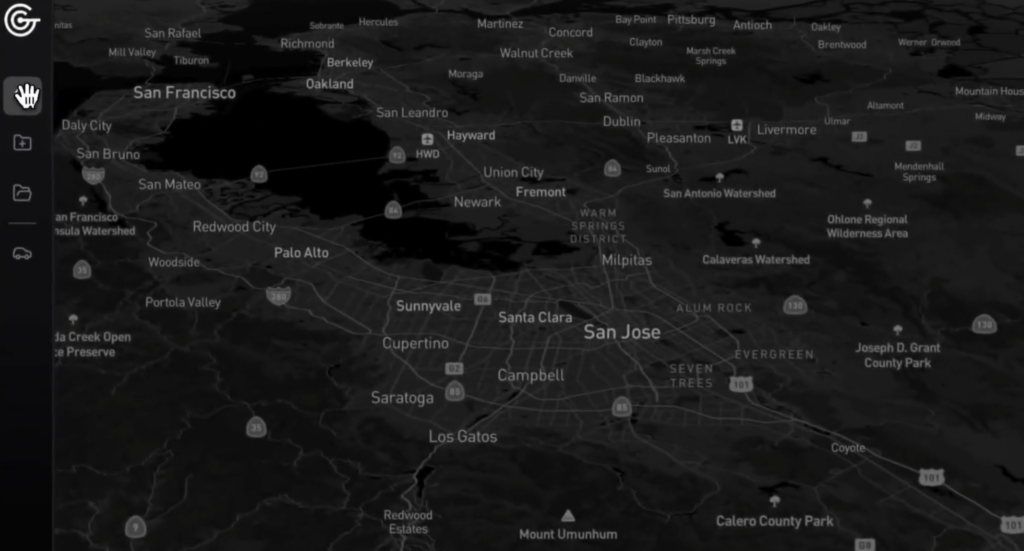
Older location inference often depended on metadata, obvious landmarks, or reverse image search against already indexed places. GeoSpy is marketed around something more unsettling: low-context images. Its homepage says the platform can take images with little obvious context and still estimate location using only pixel information. That claim is what gives the system its shock value. It suggests that even a photo with no Eiffel Tower, no street sign, and no geotag may still contain enough latent information to narrow the map dramatically.
It also feels different because of who the product is built for. Graylark does not present GeoSpy primarily as a consumer toy. It markets advanced AI location intelligence to law enforcement, government, and enterprise users, and its site explicitly positions the company around mission success and investigations. That framing pushes GeoSpy out of the “neat AI trick” category and into the far more consequential category of surveillance-adjacent infrastructure.
The public reporting around the company sharpened that perception. In January 2025, 404 Media reported that members of the public had been able to use GeoSpy and that the tool raised stalking concerns. Heise then reported that Graylark closed public access after that reporting. By February 2026, 404 Media reported that internal police emails showed confirmed purchases by the Miami-Dade Sheriff’s Office and the Los Angeles Police Department for investigative use.
That sequence matters. A technology that begins with broad or public experimentation and then retracts access after misuse concerns is not just another startup growth story. It is a case study in how a capability can outrun its social guardrails. GeoSpy became news not only because it worked, but because it made the consequences of working too visible to ignore.
How the system probably narrows a location
GeoSpy’s own blog material offers a useful window into the logic, even if it does not disclose the full stack. The company describes a world in which geolocation can rely on a mix of retrieval, classification, and hybrid methods. In practice, that means comparing an image against large geotagged corpora, classifying it into likely geographic cells or regions, and using multiple weak signals together until the location hypothesis becomes stronger.
The examples Graylark uses are revealing. A hydrant paint style, a coffee shop sign, the spacing between buildings, a specific type of gravel, or the surface of a road may not be enough individually. Together, though, they form a pattern. This is one of the core strengths of modern visual systems: they do not need one giant clue if they can aggregate a hundred small ones. Human analysts do this too, but they do it more slowly and often with much smaller memory and search capacity.
GeoSpy’s April 2025 writing also makes a clean distinction between geoestimation and geomatching. Geoestimation tries to place a photo into the right city, region, or country using broad visual characteristics and global image data. Geomatching, by contrast, works against dense reference imagery from mapping services or other image collections to locate a much more exact match. That is a useful mental model for understanding the platform: first reduce the search space, then attempt a precise match.
This is also why coverage matters so much. Global estimation can work at a relatively coarse level with huge geotagged datasets, but street-level or property-level accuracy depends on dense, up-to-date reference imagery. A model cannot reliably match what it has never seen or what is poorly represented in the database. That is one reason the latest research still finds strong regional bias and uneven performance. The world is not equally photographed, equally mapped, or equally legible to machine vision.
Where GeoSpy could be genuinely useful
There is a reason tools like this attract serious institutional interest. In digital investigations, a single image is often the only available lead. GeoSpy’s own materials frame photo geolocation as useful across security-related workflows, and Graylark repeatedly ties its products to investigations, law enforcement, and government analysis. Even critics of the technology usually concede the same point: the underlying capability can be useful in legitimate cases.
GeoSpy’s published examples lean heavily in that direction. The company has written about locating a vehicle photo in 30 seconds, describes a two-step workflow that moves from coarse prediction to exact address-level matching, and has posted marketing material around faster investigative action. Again, those are company-selected examples rather than independent evaluation, but they make the intended use unmistakable.
The strongest case for systems like GeoSpy is not hard to imagine. If investigators are trying to verify the origin of an image tied to a violent threat, a trafficking lead, a stolen asset, or an urgent manhunt, a model that can narrow the search from “somewhere in the world” to “this neighborhood” may save critical time. That is the same argument that has historically justified other OSINT and computer-vision tools: speed can matter, and images often carry more evidence than they appear to.
Why the privacy backlash is so intense
The privacy problem begins with a simple misconception that many people still hold: if you strip metadata, you have protected location. GeoSpy’s own blog essentially explains why that is no longer enough. Platforms often remove EXIF data, but visual content itself still leaks geography through architecture, flora, weather, interiors, road paint, utility lines, and all the minor environmental signatures embedded in a shot.
That turns ordinary posting behavior into a much riskier act than many people realize. A bathroom selfie, a kitchen photo, a driveway snapshot, a balcony view, or even a pet picture can become a location puzzle. Not always solvable, not always precise, but often far more revealing than users assume. The unsettling part is not merely that a trained analyst could do this. It is that AI can compress the time, expertise, and patience required.
The misuse scenario is not hypothetical. Reporting in early 2025 tied GeoSpy to public concern about stalking, and Heise reported that public access was shut after that scrutiny. Later research has only intensified the concern. A February 2026 benchmark on contextual privacy found that leading vision-language models can geolocate images precisely while remaining poorly aligned with human privacy expectations, often over-disclosing in sensitive contexts and remaining vulnerable to prompt-based attacks.
This is the point where GeoSpy stops being only a product story and becomes a civil-liberties story. Once a model can infer location from weak visual traces, privacy is no longer just a matter of what information you explicitly share. Privacy becomes a matter of what the background reveals, what the model already knows, and who is allowed to ask the question.
What GeoSpy reveals about the future of visual AI
GeoSpy is important even for people who never use it. It reveals the direction of travel for visual intelligence systems. Graylark’s own writing says that photo geolocation was just the start and frames the broader ambition as “visual super intelligence,” meaning AI that can infer consequential information from tiny, easily overlooked visual details. That is an expansive claim, but it captures the strategic logic of the field. Once a model can answer “where was this taken,” it is already halfway to answering “what does this scene imply?”
That shift has major consequences. A world full of cameras, public photos, street imagery, property listings, and social posts becomes a training ground for models that learn not just objects but environments, spatial patterns, socioeconomic signatures, and behavioral context. GeoSpy’s published distinction between broad estimation and exact matching hints at a larger pipeline where one model narrows context and another model resolves identity, place, or property.
The likely long-term outcome is not one dominant geolocation app. It is a wider class of multimodal systems that can infer more than users expect from less than users notice. Research already shows both capability growth and uneven alignment with privacy norms. GeoSpy simply makes that future visible earlier than most people were prepared for.
What ordinary users should take from this
The first lesson is brutally simple: a photo background is data. It is not decoration. A wall texture, a plant species, a road marking, a power line, a window shape, a skyline reflection, a local shop label, or the layout of a kitchen can all function as geographic signals. GeoSpy’s own educational posts spell out many of these clues in practical terms, from weather and terrain to construction materials and real-estate imagery.
The second lesson is that privacy habits have to mature beyond “turn off location services.” That still matters, but it is no longer sufficient. Safer sharing increasingly means being conscious of what the scene itself gives away. Cropping, blurring, neutral backgrounds, delayed posting, and caution around home, school, hotel, workplace, or child-related images are no longer paranoid habits. They are an appropriate response to what visual inference can already do. The need for that caution is reinforced by the reported misuse concerns around GeoSpy and by recent research on privacy misalignment in geolocating vision models.
The third lesson is political as much as personal. If tools like GeoSpy are going to be used in policing, intelligence, insurance, fraud detection, or private investigations, the public debate cannot stop at “this is impressive.” Questions about auditability, error rates, bias, retention, logging, access control, and evidentiary standards become unavoidable. Even 404 Media’s reporting on police use describes the technology as generating investigative leads rather than self-sufficient truth, which is exactly the caution any serious deployment should preserve.
GeoSpy matters because it collapses a comforting illusion. For years, people assumed that if they withheld explicit location data, the image itself was mostly safe. That assumption is breaking. The real shock is not that GeoSpy exists. The real shock is how clearly it shows that the age of hidden location is ending. What used to require patient specialists can now be accelerated by models, products, and procurement budgets. Once that becomes normal, the meaning of a “harmless photo” changes with it.
Reference table
| Term | Definition |
|---|---|
| GPS | Global Positioning System. A satellite-based navigation system that provides geolocation and time information to a receiver anywhere on or near Earth, provided there is an unobstructed line of sight to multiple satellites. In the context of image geolocation, GPS is highly relevant because many photos and mobile devices can embed exact latitude and longitude data into image metadata, making location attribution straightforward unless that metadata is removed. |
| GNSS | Global Navigation Satellite System. A broader umbrella term for satellite-based positioning systems, including GPS, Galileo, GLONASS, and BeiDou. In professional geolocation and mapping contexts, GNSS is the more technically accurate term when referring to satellite-derived positioning in general rather than the specific U.S. GPS constellation alone. |
| EXIF | Exchangeable Image File Format. A standard for storing metadata inside image files, including information such as camera model, exposure settings, timestamp, and sometimes geographic coordinates. EXIF data is central to privacy discussions because even when a photo appears visually harmless, embedded metadata may reveal exactly where and when it was taken unless the file has been sanitized. |
| XMP | Extensible Metadata Platform. A metadata framework developed by Adobe for embedding structured information into digital media files. XMP can store descriptive, administrative, and rights-related metadata, and in some workflows it may complement or extend EXIF fields. For investigators and analysts, XMP can provide valuable contextual clues about file history, editing, authorship, or asset management. |
| IPTC | International Press Telecommunications Council. In image workflows, the term usually refers to IPTC metadata standards used to store descriptive information such as captions, keywords, creator details, copyright notices, and editorial context. Although IPTC metadata is not primarily geospatial, it can still contribute to attribution, provenance analysis, and contextual interpretation of an image. |
| OSINT | Open-Source Intelligence. The systematic collection and analysis of publicly available information for investigative, journalistic, security, or research purposes. In visual geolocation, OSINT often combines image analysis with maps, satellite imagery, social media posts, business listings, real-estate databases, street-level views, and public records to identify where a photo was taken. |
| SOCMINT | Social Media Intelligence. A specialized branch of intelligence work focused on extracting insights from social platforms, user-generated content, interaction patterns, profiles, hashtags, and shared media. In geolocation practice, SOCMINT can help correlate a photo with place-based behaviors, local networks, recurring venues, travel patterns, or previously posted imagery. |
| VLM | Vision-Language Model. A multimodal model designed to process and relate visual information and natural language within a shared reasoning framework. In the geolocation domain, VLMs can inspect an image, identify contextual cues such as architecture, vegetation, road design, signage, weather, or interior features, and then express location hypotheses or reasoning in human-readable form. |
| LLM | Large Language Model. A neural language model trained on large-scale text corpora to generate, summarize, classify, and reason over language inputs. In geolocation-related workflows, LLMs may not interpret raw pixels directly unless coupled with vision components, but they can still support investigative reasoning, synthesis of clues, hypothesis ranking, or explanation of likely geographic indicators. |
| CV | Computer Vision. A field of artificial intelligence and machine perception concerned with enabling systems to interpret, analyze, and derive meaning from visual data such as photographs, video, and imagery streams. Visual geolocation is one of its more complex applications because it requires models to infer geographic context from subtle environmental and structural patterns rather than from explicit labels alone. |
| CNN | Convolutional Neural Network. A class of deep neural network architectures particularly effective for image recognition and feature extraction. CNNs played a foundational role in modern image geolocation by learning spatial hierarchies of visual patterns such as textures, façades, vegetation structures, road markings, and skyline compositions that can be statistically associated with specific regions. |
| ViT | Vision Transformer. A transformer-based architecture adapted for image understanding by treating image patches as tokenized inputs. ViTs have become important in modern large-scale visual systems because they can capture long-range relationships across an image and often perform strongly in tasks requiring nuanced contextual interpretation, including scene recognition and visual geolocation. |
| CLIP | Contrastive Language-Image Pretraining. A multimodal training approach in which images and text are aligned in a shared embedding space through contrastive learning. CLIP-like methods are influential in geolocation-related research because they help models connect visual content with descriptive concepts, semantic categories, and place-related textual patterns, improving retrieval and scene understanding. |
| GeoCLIP | Geographic Contrastive Language-Image Pretraining. A geolocation-focused adaptation of contrastive learning methods intended to better align visual information with geographic coordinates or location-aware representations. In practice, GeoCLIP refers both to a specific research direction and to a benchmark-relevant model family that helps demonstrate how multimodal embedding methods can improve worldwide image geolocalization. |
| IM2GPS | Image-to-GPS. A landmark research concept and paper that demonstrated how a single image could be matched against a large corpus of geotagged reference images to estimate its geographic location. IM2GPS is historically important because it helped establish image geolocation as a serious computational problem rather than a purely human OSINT skill. |
| GIS | Geographic Information System. A framework for capturing, storing, analyzing, and visualizing spatial or geographic data. In geolocation operations, GIS platforms can be used to map hypotheses, compare terrain or infrastructure patterns, overlay public datasets, and contextualize photo-derived location estimates within real-world geographic layers. |
| API | Application Programming Interface. A structured interface that allows one software system to interact with another programmatically. In the context of geolocation products, an API can enable investigators, enterprise systems, or analytic platforms to submit image inputs, retrieve location estimates, integrate scoring results, and automate large-scale workflows without relying exclusively on a graphical user interface. |
| OCR | Optical Character Recognition. A technology used to detect and convert text contained in images into machine-readable characters. In geolocation work, OCR can be highly valuable when photographs contain street names, license plates, storefront text, utility markings, posters, menus, or local language fragments that help narrow down the location. |
| UAV | Unmanned Aerial Vehicle. Commonly known as a drone, a UAV is an aircraft operated without an onboard human pilot. In geospatial and investigative settings, UAV imagery can provide additional visual perspectives for terrain comparison, infrastructure verification, or site analysis, and may complement ground-level photo geolocation workflows. |
| CCTV | Closed-Circuit Television. A video surveillance system in which signals are transmitted to a limited set of monitors or recording devices rather than broadcast publicly. CCTV footage can be relevant to image geolocation because still frames extracted from surveillance video may contain environmental cues that support the identification of a specific street, building, or property. |
| POI | Point of Interest. A specific geographic location considered relevant within mapping, navigation, or intelligence workflows, such as a store, landmark, transit hub, government office, hotel, or other named site. In geolocation analysis, POIs help convert broad geographic hypotheses into operationally useful candidate locations. |
| ROI | Region of Interest. A selected area within an image chosen for focused analysis because it contains the most diagnostically useful information. In geolocation tasks, a ROI may include signage, façades, road surfaces, vegetation clusters, horizon lines, or architectural details that materially improve location inference. |
| SKU | Stock Keeping Unit. A retail inventory identifier used to distinguish specific products or product variants. Although not a geolocation term in the strict sense, SKUs can occasionally matter in visual investigations if a photographed item is region-specific, retailer-specific, or linked to a local distribution pattern that helps narrow down geographic origin. |
| Portable Document Format. A file format designed to preserve document layout and visual consistency across devices and platforms. In investigative or geospatial workflows, PDFs may contain maps, reports, planning documents, property records, or evidentiary bundles relevant to validating or contextualizing image-derived location assessments. | |
| JPEG | Joint Photographic Experts Group. Commonly used to refer to the widely adopted compressed image format standardized by that group. JPEG files are frequently encountered in geolocation tasks because they often contain EXIF metadata, and even when metadata is removed, the visual content may still provide rich inferential clues about place. |
| PNG | Portable Network Graphics. A raster image format designed for lossless compression and high-quality digital image storage. PNG images are common in screenshots, interface captures, and social media reposts, and while they may not always preserve the same metadata structure as camera-originated JPEG files, their visible content can still be highly informative in visual location analysis. |
| LAPD | Los Angeles Police Department. The municipal law enforcement agency for the City of Los Angeles. In the GeoSpy discussion, the acronym is relevant because public reporting identified the LAPD as one of the agencies associated with procurement or investigative interest in AI-assisted photo geolocation tools, placing the technology firmly within real institutional practice rather than speculative use. |
| MDSO | Miami-Dade Sheriff’s Office. A county-level law enforcement body in Florida. The acronym is relevant in GeoSpy-related reporting because it has been cited as one of the agencies connected to confirmed purchasing or operational interest in geolocation technology derived from image analysis. |
| R&D | Research and Development. The organizational function devoted to experimentation, technical innovation, prototyping, and applied advancement of products or systems. In the context of visual geolocation, R&D is where improvements in scene matching, geographic inference, model accuracy, bias reduction, and operational scaling are typically developed before reaching commercial deployment. |
| UX | User Experience. The overall quality of a user’s interaction with a system, including usability, clarity, workflow efficiency, confidence, and cognitive burden. For geolocation products, UX is especially important because complex model outputs must be presented in ways that help analysts interpret uncertainty, compare candidates, and avoid overconfidence in seemingly precise results. |
Sources
GeoSpy official homepage
Official product page describing GeoSpy as an AI image geolocation platform that can infer location from pixels alone and is aimed at professional use cases.
https://geospy.ai/
Graylark official company site
Company page explaining Graylark’s positioning, target customers, and product categories including Global Search, Street Search, and Property Search.
https://graylark.io/
GeoSpy 101 What Is GeoSpy
Official GeoSpy article explaining the product’s core idea and how pixel-based geolocation works.
https://geospy.ai/blog/geospy-101-ai-visual-geolocation
What Is Photo Geolocation
Official GeoSpy article outlining the foundations of photo geolocation, key technical approaches, and the privacy implications of visual location inference.
https://geospy.ai/blog/what-is-photo-geolocation
Locating a Photo of a Vehicle In 30 Seconds With GeoSpy
Official GeoSpy article describing the distinction between geoestimation and geomatching and presenting Graylark’s claimed accuracy improvements.
https://geospy.ai/blog/locating-a-photo-of-a-vehicle-in-30-seconds-with-geospy
Cops Are Buying GeoSpy AI That Geolocates Photos in Seconds
404 Media report on confirmed law-enforcement purchases of GeoSpy and how agencies described its role in investigations.
https://www.404media.co/cops-are-buying-geospy-ai-that-geolocates-photos-in-seconds/
Graylark closes public access to AI tool for geolocation
Heise report on the closure of GeoSpy’s public access after scrutiny over misuse and stalking concerns.
https://www.heise.de/en/news/Graylark-closes-public-access-to-AI-tool-for-geolocation-10252293.html
IM2GPS Estimating geographic information from a single image
Foundational academic paper that helped establish large-scale image geolocation as a serious computer-vision problem.
https://graphics.cs.cmu.edu/projects/im2gps/im2gps.pdf
GeoCLIP Clip-Inspired Alignment between Locations and Images for Effective Worldwide Geo-localization
Research paper on a modern approach to worldwide image geolocation using aligned image and GPS representations.
https://arxiv.org/abs/2309.16020
Image Based Geolocation with Large Vision Language Models
Academic paper examining how large vision-language models perform on geolocation tasks and what privacy risks follow from those capabilities.
https://petsymposium.org/popets/2025/popets-2025-0137.pdf
From Pixels to Places A Systematic Benchmark for Evaluating Image Geolocalization Ability in Large Language Models
Benchmark paper on geolocation performance, bias, and reasoning patterns in modern language-and-vision systems.
https://arxiv.org/abs/2508.01608
Do Vision-Language Models Respect Contextual Integrity in Location Disclosure
Recent research showing that powerful multimodal models can over-disclose location information and diverge from human privacy expectations.
https://www.researchgate.net/publication/400505468_Do_Vision-Language_Models_Respect_Contextual_Integrity_in_Location_Disclosure
Author:
Jan Bielik
CEO & Founder of Webiano Digital & Marketing Agency