
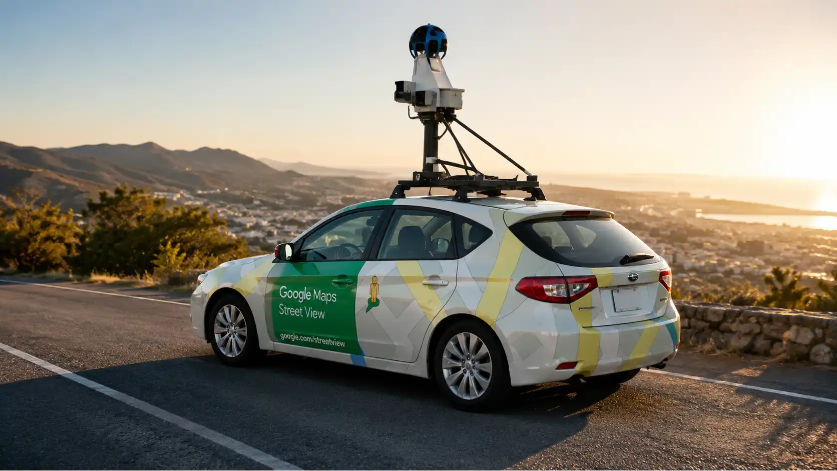
A Google Street View car passing a home creates a peculiar kind of exposure. The camera is usually outside, on a road or another mapped route, yet its elevated panoramic system can record people, vehicles, windows, gardens, entrances, signs, deliveries, security equipment, and the ordinary mess of life. The central privacy question is not whether a camera saw something from the street, but what happens when that moment becomes searchable, geolocated, persistent, and globally accessible. A passer-by sees a frontage once. A mapping platform can convert the same view into a durable reference tied to an address and available to strangers at any hour.
Table of Contents
The camera car and the real privacy question
Google says Street View photographs come from Google and contributors, that Google-owned imagery is labeled accordingly, and that faces and license plates are automatically blurred. Its policy also says the imagery is not real time: processing can take months, and published scenes may be months or years old. Those facts reduce some risks, especially immediate tracking, but they do not eliminate the privacy impact of publication. A blurred face may still be recognizable from clothing, posture, companions, a distinctive vehicle, or the fact that only one person lives at the address. A house can reveal occupancy patterns, accessibility features, religious symbols, children’s play equipment, expensive assets, or a business operating from home.
The word “security” also needs precision. Street-level imagery can assist navigation, emergency planning, accessibility research, property assessment, and public-interest analysis. It can also support remote reconnaissance, allowing someone to study gates, side paths, loading areas, cameras, fences, intercoms, and sightlines without visiting. That does not mean Street View causes burglary or stalking, and public evidence rarely establishes a simple causal link. It means the service lowers the cost of observing visible details. The risk grows when imagery is combined with address databases, social media, property listings, public records, data-broker profiles, or knowledge of a specific person’s routines.
Privacy law does not treat every visible object alike. An identifiable person normally raises stronger data-protection questions than a brick wall. A building image may become personal data when it relates to an identifiable resident, exposes information about that person, or is linked with other identifying material. Ireland’s Data Protection Commission, for example, distinguishes images of people and vehicle registrations from views of property or pets, while broader European and UK definitions focus on information relating to an identified or identifiable natural person. Context can turn an apparently neutral property image into information about a person. The legal answer therefore depends on the image, the purpose, the jurisdiction, and the possibility of identification, not merely on whether the camera stood on public ground.
A useful analysis separates four stages. Capture asks where the vehicle was, what the camera could see, and whether local rules restricted collection. Processing asks what identifiers were detected, blurred, stored, or used for other purposes. Publication asks what appears at the address, how long it remains available, and whether older versions can be opened. Downstream use asks whether people, companies, researchers, or automated systems extract further inferences. Most household anxiety concerns publication and downstream use, even when capture itself was lawful.
The practical response is neither panic nor blind trust. A resident should inspect current and historical imagery, identify concrete exposure, distinguish Google-owned panoramas from contributor uploads, preserve evidence, and use the correct reporting route. A blur request should be specific because Google describes an applied blur as permanent. People facing stalking, domestic abuse, threats, or sensitive professional exposure should treat Street View as one layer in a larger address-security plan rather than as the sole problem. The camera car is visible and memorable; the more serious exposure often comes from the way many datasets combine around the same location.
A useful distinction is between exposure and harm. Exposure means information became available; harm may involve intimidation, discrimination, theft, embarrassment, unwanted contact, or loss of control. Not every exposure produces harm, but the absence of proven harm does not make a privacy concern irrational. Preventive controls exist because people should not have to suffer an incident before a platform takes a narrowly framed request seriously. At the same time, a credible complaint should avoid speculation. It should identify the visible detail, the person or property affected, the pathway by which someone could connect it to them, and the proportionate remedy sought.
A measured response protects real interests while preserving the legitimate public value of accurate maps.
A public street does not erase private life
Photography from a public road is often discussed as though “publicly visible” and “private” were opposites. They are not. A person can have a legally and socially protected interest in details that are visible for a few seconds from one viewpoint, particularly when technology turns those details into a named, searchable record. Visibility is a condition of capture, not a complete answer to publication, scale, retention, or reuse. The distinction matters because Street View is not merely a driver looking through a windscreen. It is an industrial imaging system that records broad surroundings, attaches location data, processes the result, and distributes an interactive panorama.
Ordinary expectations are shaped by practical obscurity. A stranger might walk past a home, notice a bicycle in the yard, and forget it. To rediscover the detail, the stranger would have to return. Street View changes that friction. A viewer can search an address, zoom, rotate the scene, compare dates where historical imagery is available, and share a link. Google confirms that users can access imagery from other dates in some locations through the Street View archive. Persistence and retrievability can make a familiar street scene more revealing than the same scene experienced in person.
This does not create an automatic right to suppress every facade. Buildings contribute to navigation, urban understanding, and public records. Street scenes contain information that societies routinely permit people to observe and document. The legal balance differs among countries, and even within one country it may involve data protection, privacy torts, trespass, harassment, consumer law, image rights, constitutional rules, or sector-specific restrictions. A resident should be cautious of sweeping claims such as “Google may photograph anything visible” or “showing my house is always illegal.” Both statements ignore jurisdiction and context.
The European Data Protection Board’s video-device guidance illustrates the more careful approach. It explains that recorded images of identifiable people can be personal data and that risks rise with the size of the monitored space and the number of people affected. The guidance addresses systematic monitoring rather than Street View alone, but its reasoning is useful: identifiability, purpose, necessity, proportionality, transparency, retention, and safeguards all matter. It also states that data with no reference to a person falls outside the GDPR. The same panorama can contain protected personal data in one area and non-personal architectural information in another.
Property boundaries add another layer. A camera on a public road may see through an open gate or over a low hedge without physically entering the land. That differs from a vehicle driving onto a private road, driveway, courtyard, or restricted facility. The second situation may raise trespass, access, contract, or local mapping-permission questions independent of data protection. Proof matters: signage, land records, gate positions, the panorama’s route line, capture date, and any contemporaneous video may establish where the vehicle went. A complaint that only says “this is private” may fail if the disputed route is legally open to the public or mapped ambiguously.
Privacy also varies with human vulnerability. A public figure, a shelter resident, a child, a person escaping abuse, and a homeowner with no known threat do not face equal consequences from the same image. A wheelchair ramp may be an ordinary building feature, yet it may imply health-related information about an identifiable occupant. A political sign can be generic speech, but at a single-resident address it can be linked to an individual. Children’s toys do not prove that a particular child lives there, but they can contribute to an inference when combined with school posts or family profiles.
The safest principle is contextual minimization: publish what serves the mapping purpose, obscure what identifies or endangers people without adding navigational value, and provide a usable remedy when automation misses something. For residents, that means describing the concrete harm rather than relying only on ownership. For platforms, it means recognizing that “seen from the street” is the beginning of the analysis, not its end.
The elevated camera position can intensify this gap between ordinary observation and platform observation. A roof-mounted system may see across a low wall or hedge from an angle unavailable to a pedestrian. That does not automatically make collection unlawful, but it changes the factual record. Residents documenting a concern should compare the apparent camera height, road position, boundary, and line of sight instead of assuming that every visible area was equally exposed to normal passers-by. A privacy assessment should describe the actual vantage point.
The image pipeline from capture to publication
Understanding the pipeline helps separate what the passing car records from what the public eventually sees. Google describes Street View as a collection of 360-degree imagery gathered through cars and other equipment, while contributor imagery forms a separate source with its own attribution. The public panorama is therefore a processed product rather than a raw camera feed. Collection, stitching, geolocation, automated detection, quality review, blurring, publication, archival storage, and later reuse are distinct operations with different privacy risks.
At capture, roof-mounted cameras take overlapping views around the vehicle. Positioning and motion data help align those views with a route. Panoramic systems must correct perspective, join frames, manage moving objects, and choose which imagery represents a point on the map. The resulting scene can contain seams, duplicated people, distorted vehicles, partial bodies, or temporal mismatches because different directions may have been captured fractions of a second apart. These artifacts are not merely cosmetic. They can affect whether a face detector recognizes a person, whether a plate remains readable, and whether a viewer misinterprets what happened.
Google’s published research on large-scale privacy protection described automated face and license-plate detection as the basis for blurring Street View imagery. Automation is necessary at global scale, but detection systems inevitably face small objects, oblique angles, glare, shadows, occlusion, unusual plate designs, masks, helmets, reflections, and low contrast. A privacy safeguard that performs well on average can still fail for the one person who matters in a particular frame. The appropriate test for a resident is not the vendor’s aggregate performance but whether the specific image reveals an identifier.
After detection, the system applies blur to selected regions. Blurring is a transformation, not disappearance. The surrounding body, vehicle type, house number, business sign, uniform, shopping bag, pet, or companion can remain visible. A misaligned blur may cover part of a face while leaving a profile, tattoo, or reflection clear. Conversely, an overbroad blur can obscure a storefront, architectural feature, or vehicle that the owner wanted visible. Google’s help materials allow requests involving a home, vehicle, full body, or inappropriate content, and state that an applied blur is permanent. Current help text also says newly blurred Street View imagery is excluded from generative-AI prompting from that point onward, while the request does not undo AI-generated imagery already created or published by third parties.
Publication adds the address relationship. A photograph in an unindexed archive may be difficult to connect to a person. Street View is designed for place retrieval, so the geographic association is central. The map interface can expose the street, building number, nearby businesses, access roads, and directions. Historical imagery can preserve earlier states where available, and Google notes that the displayed scene may be months or years old because processing takes time. The publication date, capture date, and date a person discovers the image may all differ.
Archival and downstream stages deserve equal attention. A current view may be blurred while an older contributor panorama, property listing, cached screenshot, or third-party dataset remains accessible. Removing or blurring the Google-hosted view does not guarantee deletion from websites that copied it lawfully or unlawfully. Nor does it alter what a visitor personally recorded. That is why a response should document every distinct source rather than assume a single report reaches the whole ecosystem.
The pipeline also clarifies responsibility. Google controls Google-contributed imagery and its processing choices. A user controls the original contribution subject to platform rules, while Google controls hosting and enforcement. A researcher or business using imagery becomes responsible for its own extraction, linkage, and decisions. Privacy accountability follows the operation being performed, not simply the logo visible on the map. A precise complaint identifies the panorama owner, date, location, exposure, requested remedy, and any special safety context. Precision makes it easier to route the problem to the party capable of fixing it.
Quality control then determines whether the panorama is publishable, but public documentation does not provide a complete operational map of every internal review, retention period, model input, or exception. Readers should distinguish between verified policy statements and assumptions about hidden systems. Where the public sources are silent, the responsible conclusion is uncertainty. A data-access or regulatory complaint may be needed to obtain a more specific answer, and the available remedy can depend on whether the complainant is asking about the public image, the underlying personal data, or later model use.
Automatic blurring protects identifiers, not context
Automatic face and license-plate blurring is the most visible Street View privacy control. It addresses two identifiers that can connect a street scene to a person quickly: facial appearance and vehicle registration. Google states that it automatically blurs identifiable faces and plates in Google-owned imagery. That is a meaningful safeguard, but blurring should be understood as risk reduction, not anonymization of the entire scene. The person, vehicle, location, date, and surrounding circumstances remain partially observable.
True anonymization requires more than making one field difficult to read. UK data-protection guidance warns that information is not anonymous if an individual can still be identified through reasonably available means. Street imagery offers many linking features: a distinctive coat, wheelchair, company uniform, rare car model, customized van, tattoo, dog, route, front door, or association with another visible person. At a sparsely occupied rural address, a blurred figure near the only house may be obvious to neighbors. At a business, clothing and shift timing can identify an employee. Location itself is often the strongest identifier in a geolocated image.
License-plate blur has similar limits. Hiding the characters prevents immediate transcription, but the vehicle’s make, model, color, damage, decals, roof equipment, parking place, and relationship to the property can remain visible. A company fleet vehicle may display branding and a unit number. A rare collector car can be identifiable without a plate. A delivery van may reveal which service visited a medical clinic or shelter. The privacy question becomes whether the remaining details relate to an identifiable person and whether publication creates a material risk.
Body-level recognition is especially important for children and vulnerable adults. A face can be blurred while school clothing, sports kit, mobility equipment, or a distinctive body shape remains visible. Google’s help route permits a request to blur a full body, which implicitly recognizes that a face-only treatment may be insufficient. Residents should use that category when the whole figure, not merely the face, creates identification or safety concerns. A report should explain why the person remains identifiable rather than simply asserting that the blur “looks weak.”
Reflections create another failure mode. Faces and plates may appear in mirrors, windows, polished vehicles, shop displays, or water. Detection systems trained on direct views may handle reflected, tiny, or distorted identifiers less reliably. Printed photographs, posters, digital screens, and signs can also contain faces that are not treated like people in the scene. Manual inspection remains necessary when an image concerns a specific person or sensitive site. A household audit should rotate the panorama fully, zoom conservatively, check adjacent capture points, and inspect historical dates.
Blurring can also remove useful evidence. A homeowner disputing damage, access, construction, or a boundary may rely on historical imagery. Once a requested house blur is permanent, the requester may lose convenient access to details that later support a claim. The same blur can frustrate customers trying to recognize a storefront. A request should therefore target the smallest area that solves the privacy problem, when the interface permits that level of specificity. Google, not the requester, determines the final application, so screenshots should be retained before submission.
There is also a difference between visual obscurity and data deletion. A blurred public panorama may coexist with an unblurred internal source image, derived metadata, model training record, or previously exported copy, depending on the platform’s architecture and legal obligations. Google’s current policy expressly discusses Street View use for generative AI, and its help text links new blur requests to exclusion from future prompting. That makes downstream handling part of the privacy assessment.
The right question is whether the published and reused material can still identify, characterize, or endanger someone. Face and plate blur answer only part of that question. Contextual identifiers, property linkage, archives, contributor images, and secondary datasets require separate review.
Blurring itself may attract attention. A completely obscured house stands out in an otherwise clear street, encouraging some viewers to search property portals, aerial imagery, contributor photos, or archived screenshots. This does not mean a person should avoid a necessary blur; it means obscurity should be part of a layered plan. Remove unnecessary address disclosures elsewhere, review public records that can lawfully be corrected, tighten social-media location sharing, and ask household members not to post identifiable exterior views during periods of elevated risk.
The remaining context deserves the same careful review as the pixels hidden by the automated mask.
Property details that remain visible after blurring
A house does not have a face to blur. Its privacy exposure comes from details that reveal how people live, enter, store possessions, receive services, or protect themselves. Street View may show gates, fences, doorbell cameras, alarm boxes, window bars, intercoms, package locations, side paths, garages, bicycles, mobility ramps, solar equipment, children’s toys, political signs, religious objects, business names, and visible interiors. Most of these features are not automatically hidden because they are part of the mapped environment rather than standard personal identifiers.
The security significance of any one feature is easy to exaggerate. A visible gate does not prove that a property is vulnerable, and a camera location shown in an old panorama may have changed. Google says imagery is not real time and can be months or years old. That delay limits immediate surveillance but does not make the view harmless. Structural features often persist: an alley remains an alley, a detached garage remains behind the house, and a service entrance may remain poorly observed. Age reduces some operational value while preserving much of the site layout.
Property exposure becomes more sensitive when combined with other sources. Real-estate listings can reveal interior plans and room photographs. Planning portals may show drawings. Social media can announce travel. Business websites list opening hours. Data brokers associate names, relatives, phones, and addresses. Street View supplies the visual bridge between those records and the physical site. The platform is rarely the only source, yet it can make the combined profile easier to understand. Security planning should therefore address the information bundle rather than treating one panorama as an isolated leak.
Some details imply personal information. A wheelchair ramp at a single-occupant home may support an inference about disability, although it could belong to a visitor or previous resident. A campaign poster may imply political preference, but not necessarily that of every occupant. A religious symbol may relate to belief, decoration, or a former tenant. Inference is not certainty, but uncertain inferences can still affect people when automated systems or strangers act on them. European and UK privacy frameworks treat identifiability and relation to a person as contextual questions, while special-category rules apply when data actually concern matters such as health, religion, or political opinions.
Visible interiors deserve close attention. A camera on an elevated mount may see over a hedge or through an unobstructed window. The lawful status depends on location and jurisdiction, but the practical remedy is clearer: record the panorama, identify the exact window or room, and request targeted blurring where the image exposes private domestic activity or sensitive objects. Curtains, reflective film, planting, and window orientation can reduce future exposure, though residents should not be expected to redesign their homes merely to compensate for mass imaging.
House numbers and signs are functionally important for navigation, deliveries, and emergency access. Hiding them can reduce mapping value. Yet they also make a panorama easier to connect with a named resident. Google Maps already associates imagery with coordinates and addresses, so removing a number from the photograph does not remove the address relationship. A house-level blur may be the only practical platform remedy for someone facing a targeted threat, but it can draw curiosity because the blur itself is conspicuous. There is no universal answer; the safest option depends on threat level, not aesthetics.
Small businesses face a different trade-off. A clear frontage helps customers identify an entrance, evaluate parking, and understand accessibility. Blurring may hurt discovery or create confusion, especially for clinics, workshops, or shops operating from converted homes. The owner should separate customer-facing features from private areas and request only the necessary obscuration when possible. A contributor photo uploaded to the place listing may remain visible even if the official Street View panorama is blurred, so each source must be checked.
A useful property audit asks three questions. Does the image reveal an enduring layout or access feature? Does it connect that feature to a vulnerable person or valuable asset? Does another public source add timing, identity, or interior detail? Risk emerges from the combination of visibility, linkage, persistence, and adversary interest. That framework avoids both complacency and unsupported claims that every photographed facade is a security breach.
Research shows street-level imagery can classify buildings and generate neighborhood indicators. That does not prove a particular insurer, lender, landlord, or employer uses Google Street View in an individual decision. Automated extraction is verified; an adverse use requires evidence. A person challenging a decision should request the data and reasons used.
People, children, visitors, and accidental exposure
People captured in Street View are rarely posing for publication. They may be walking, working, receiving care, entering a place of worship, visiting a political office, standing outside a shelter, arguing, falling, or simply appearing at an address they do not want associated with them. The image can disclose presence even when the face is blurred. Clothing, companions, mobility aids, uniforms, tattoos, body shape, a parked vehicle, and the location itself can create recognition. Google’s face-blurring system addresses a direct identifier, but the remaining scene may still relate to an identifiable person.
Children deserve particular care because they often have little control over their digital footprint and may not understand the consequences of geolocated publication. A child in a school uniform outside a home can connect a family address with a school. A child near a foster home, refuge, clinic, or custody handover point may face risks that are invisible to a reviewer. Toys, names on backpacks, sports shirts, and companions may identify them after the face is obscured. A full-body blur is more appropriate when context defeats a face-only blur. Google’s reporting route expressly includes requests concerning a full body, which gives parents and guardians a concrete remedy when the published silhouette remains identifying.
Visitors create a different privacy problem. The property owner may be comfortable with the building image, while a guest may object to being shown at that address. A vehicle owner may not be the homeowner. A contractor, nurse, therapist, union organizer, delivery worker, or religious visitor may have a legitimate concern about association. The person affected should preserve the panorama date and URL and make a request focused on their body or vehicle rather than demanding that the entire property disappear. Ownership is not always the basis of the privacy interest; the relevant interest may be the visitor’s identity and presence.
The image can also be misleading. Street View is not real time, and a single frame does not explain whether a person lived there, visited once, walked past, or happened to stop. Viewers may infer an intimate relationship, medical status, employment, political affiliation, or criminal connection from coincidence. Such inferences can be wrong yet damaging. Google’s policy says scenes may be months or years old after processing, so even a correct observation may be temporally obsolete. A former partner’s car, an old tenant, or a temporary sign can remain linked with a current address.
Sensitive locations amplify these risks. Outside addiction treatment, reproductive health, mental-health care, immigration services, domestic-abuse support, legal aid, or a place associated with a minority community, presence can reveal or suggest deeply personal information. Data-protection law may treat health, religious belief, political opinion, sexual orientation, and certain other categories as especially sensitive when information truly relates to an identifiable person. The photograph alone may not establish the fact, but repeated linkage with other sources can narrow uncertainty. Platforms should apply stronger human review where a missed blur could expose a vulnerable person at a sensitive site.
Workers may be identifiable through branded clothing, route assignment, tools, or a name badge. A face blur does not prevent an employer from recognizing an employee outside a competitor, union office, or second job. Conversely, an image could appear to show misconduct without capturing the surrounding circumstances. Employment decisions based on a dated panorama would be unreliable, and a person facing such a decision should request the image, capture date, inference, and policy used. The appropriate challenge may involve data access, discrimination law, workplace procedure, or defamation, depending on what was claimed.
Residents should inspect adjacent panorama points because a person missed in one frame may appear clearly in another. They should also check historical imagery and contributor uploads, which may have different dates and privacy handling. Screenshots should include the attribution, date, map position, and surrounding context. A strong report explains continued identifiability and concrete risk. “My face is visible” is useful; “the face is blurred, but the school logo, wheelchair, and unique doorway identify my child at a protected address” is much stronger.
Accidental exposure is inevitable in mass street photography, but unresolved exposure is not. A credible system needs automatic safeguards, accessible reporting, human escalation for vulnerable cases, and transparent handling of downstream copies. The affected person needs a focused record, a proportionate request, and realistic expectations about what one platform can remove.
Prompt correction matters.
The security value and limits of street-level reconnaissance
Street View can function as a reconnaissance tool because it lets a viewer examine a location without appearing there. A person can study road access, pedestrian approaches, parking, fences, gates, cameras, lighting, loading bays, utility equipment, neighboring sightlines, and the general relationship between a building and the street. The security effect is a reduction in the cost and visibility of preliminary observation. It does not provide live surveillance, guaranteed accuracy, interior plans, alarm status, or current occupancy. Google states that imagery is not real time and may be months or years old.
This distinction matters when assessing crime risk. It is easy to claim that a map image “shows burglars how to enter,” but a public source rarely proves that a specific offender relied on it. Many visible features could also be observed by walking or driving past. Street View changes scale and convenience: the viewer can compare many targets, revisit details, and combine the panorama with property listings or social posts. Capability is clear; causation in an individual incident requires evidence. Security advice should not rely on sensational claims that cannot be verified.
The most useful threat model asks who might care, what they seek, and what the imagery adds. An opportunistic thief may value evidence of bicycles, tools, detached garages, or poor side access. A stalker may care about a person’s entrance, parking place, neighboring cover, or route to work. A fraudster may use a facade to make a scam message more convincing. A hostile activist may study a clinic or company’s access points. A competitor might inspect a loading pattern or visible equipment. Each adversary has different skills and motivation, so the same panorama does not create equal risk for every property.
Street-level imagery also supports defense. Homeowners can use it to see what strangers see, identify overgrown concealment, improve lighting, move high-value items, or redesign delivery points. Emergency planners and accessibility researchers can assess routes remotely. Urban researchers have used large image collections to identify sidewalks, buildings, vegetation, street disorder, and other environmental features. Those public benefits explain why a blanket ban would have costs. The appropriate security goal is selective minimization, not elimination of all street imagery.
Images can be stale in dangerous ways. A newly installed gate may make an old view pessimistic, while a removed barrier may make it falsely reassuring. Vegetation, construction, camera placement, road access, tenants, and business use change. Historical imagery may reveal prior configurations but not current controls. Anyone making a security decision should verify the site directly and avoid treating Street View as authoritative. For defenders, the age of the image is a reminder to check whether old exposures still exist elsewhere.
Some details are better addressed physically than digitally. Blurring a house may hide a gate in Google-owned imagery, but the gate remains visible to visitors, delivery workers, drones, public photographs, real-estate portals, and contributor uploads. A lock, lighting improvement, privacy screen, package box, or changed routine may reduce risk across channels. Platform controls and physical controls solve different parts of the problem. The highest-risk households should also review public address records, family posts, wearable fitness maps, vehicle listings, and people-search services.
Critical and sensitive sites face broader concerns. A scholarly review of panoramic street-level imagery noted potential security issues where images show infrastructure, national-security sites, or gathering locations. The authors also warned that corporate imagery can be processed at scale and that group-level classifications can create harmful hypervisibility. This is a research warning, not proof that a particular site is endangered. It supports careful site review, coordinated requests, and policies that consider aggregated exposure rather than only faces and plates.
Security teams should document the exact feature they want obscured and why publication materially changes the threat. Vague claims invite dismissal; detailed operational claims should not be posted in a public forum. Use private reporting routes, involve law enforcement or protection specialists where a credible threat exists, and preserve the original evidence. The defensible position is proportional: keep the navigational value of ordinary streets, remove avoidable identifiers and high-risk details, and never confuse an old panorama with live intelligence.
Avoid publishing a detailed vulnerability analysis while asking for help. Public posts can repeat the gate, blind spot, code panel, or route that caused concern. Keep the full explanation for a private channel and disclose only what a reviewer needs. Remediation should not amplify the exposure. Crop screenshots carefully while retaining enough map context to locate the image.
A practical risk model for homes and small businesses
A useful Street View assessment should be repeatable rather than driven by the shock of seeing one’s home online. Risk can be evaluated through five elements: visibility, identifiability, sensitivity, persistence, and adversary interest. Visibility asks what the panorama actually shows. Identifiability asks whether the scene can be linked to a person, vehicle, household, employee, or client. Sensitivity asks what the detail reveals or implies. Persistence asks whether current, historical, contributor, or copied versions remain available. Adversary interest asks whether anyone has a reason to use the information against the subject.
Visibility should be recorded without interpretation first. List observable features: side entrance, house number, person, vehicle, access code, package, alarm box, school logo, clinic sign, interior room, high-value equipment, or private-road route. Then rate clarity and angle. A tiny object requiring aggressive enlargement is different from a readable sign. Separating observation from inference reduces exaggeration. The image date and attribution should be captured because Google-owned imagery and contributor content have different ownership and reporting paths.
Identifiability requires realistic linkage. A blurred figure in a busy city may be anonymous, while the same figure outside an isolated home may be obvious to neighbors. A generic sedan differs from a branded work van. A wheelchair ramp may relate to many possible users; a named mobility service vehicle parked beside it narrows the inference. UK guidance emphasizes direct and indirect identification and warns that data called anonymous may still permit re-identification through reasonably available means. The test is not whether every viewer knows the person, but whether identification is reasonably possible in context.
Sensitivity concerns consequences, not curiosity. A visible garden is usually low sensitivity. Evidence of a child, patient, protected witness, domestic-abuse survivor, high-value collection, religious practice, political activity, or security weakness can be much more consequential. Some details may fall into legally protected categories only when they genuinely concern an identifiable person. A risk assessment should avoid converting every object into a sensitive fact, but it should record credible implications and the evidence supporting them.
Persistence is broader than the current panorama. Google allows historical imagery in some places, and contributor images may sit beside official coverage. Screenshots, property listings, social-media posts, and research datasets can outlive a platform change. Google says an applied Street View blur is permanent, but that does not mean all third-party copies disappear. A remedy should be mapped source by source.
Adversary interest completes the model. Most homes are not being targeted. Risk rises when there is stalking, harassment, public controversy, valuable inventory, sensitive services, predictable cash handling, protected occupants, or a known dispute. The same visible side path may deserve a low rating at an ordinary residence and a high rating at a refuge. Threat assessment should be updated when circumstances change.
The model supports proportional action. Low-risk exposure may require no change. Moderate exposure may justify moving objects, updating signs, adjusting landscaping, or requesting a narrow blur. High exposure may require a house-level blur, removal of contributor content, physical security work, privacy-law requests, and professional assistance. The purpose is to choose controls that match evidence, not to produce a dramatic score.
A small business should include customer impact. A blur can make a storefront harder to find, while leaving a clinic entrance clear can expose clients. The owner may need an alternative exterior image that shows the public entrance without revealing private operations. Landlords should involve tenants because the residents, not just the property owner, may bear the privacy risk. Home workers should consider whether signage and deliveries expose the nature of the business.
The table below turns the model into a compact review tool. It is not a legal test or prediction of crime. It is a disciplined way to decide what to document, what to change, and which remedy is proportionate.
Keep scoring qualitative unless an organization has validated a numerical method. Arbitrary points create false precision. Reviewers should explain their categories and identify missing facts such as ownership, image age, identifiability, threat history, or copied versions. Uncertainty belongs in the assessment. A medium rating can mean credible exposure with uncertain consequences.
End with an owner and deadline for every action: report, verify, change a physical control, notify tenants, or recheck the map. Keep the assessment private because it may describe weaknesses.
For recurring reviews, record the next expected collection period when Google publishes local mapping plans, then repeat the same checklist after new imagery appears.
Table 1 — Street View exposure assessment
| Factor | Low concern | Medium concern | High concern | Best first response |
|---|---|---|---|---|
| Visibility | Generic facade | Clear access or assets | Interior, code, protected person | Preserve evidence and narrow the issue |
| Identifiability | No realistic link | Link possible with local knowledge | Named, unique, or address-linked subject | Request person, vehicle, or property blur |
| Sensitivity | Ordinary streetscape | Household routine or valuable item | Health, child safety, refuge, credible threat | Escalate privately and document harm |
| Persistence | One current view | Historical or contributor versions | Multiple copied or indexed versions | Build a source-by-source removal plan |
| Adversary interest | No known target | Public-facing role or dispute | Stalking, threats, sensitive operation | Combine digital and physical security controls |
The model is strongest when every rating is supported by a screenshot, capture date, attribution, and a short explanation of the realistic harm.
Temporal exposure through historical imagery
Street View can preserve change. Google’s interface allows users in some locations to open imagery from earlier dates, and its policy notes that scenes may range from a few months to a few years old. Historical access turns a single exposure into a timeline. A viewer may compare construction, occupancy, vehicles, landscaping, security measures, business signs, accessibility features, or the appearance and disappearance of people. The archive has legitimate value for navigation, planning, research, journalism, insurance disputes, and personal memory, but it also changes the privacy calculation.
A current panorama may look harmless while an older frame reveals more. A previous hedge could be lower. A garage door may have been open. A former resident’s vehicle may be unblurred. Children may appear at an earlier age. A clinic or shelter may have displayed a temporary sign. A home renovation may expose interior structure. Residents who inspect only the default image can miss the version that creates the greatest risk. Every privacy audit should check “See more dates” where the feature is available.
Historical imagery can also correct false assumptions. An apparently unsecured side entrance may have been temporary during construction. A vehicle associated with the address may belong to a former tenant. A political sign may date from an earlier occupant. The capture date is therefore central to any allegation or decision. Employers, insurers, landlords, investigators, and journalists should not treat a dated street image as evidence of current conduct without verification. A panorama is a record of what a camera could see on one collection day, not a live description of the property.
Temporal comparison enables inference. Repeated images can suggest when a business opened, when a building became vacant, when a household acquired expensive assets, or whether a ramp or security device appeared. These inferences may be useful for urban research, but they can also reveal personal circumstances. Research using Street View has measured environmental change and physical attributes over time, while authors warn that image availability and frequency can be uneven and models can produce biased results. A timeline can look precise while resting on irregular observations.
The archive complicates remediation. A blur request may apply to the selected Google-owned image or to the relevant property across imagery, depending on Google’s handling, but a resident should verify the result across dates rather than assume every frame changed. Contributor panoramas may remain. Screenshots and cached copies may persist outside Google. A person seeking relief should record each date, attribution, and identifier separately and ask the platform to clarify the scope of the action.
Historical evidence can be valuable to the resident too. It may document a boundary, road condition, sign, facade, tree, access point, or construction state. Because Google describes an applied blur as permanent, a homeowner considering a full-property blur should preserve lawful screenshots needed for personal records or pending disputes. Privacy protection can carry an evidentiary cost. The decision should be made with awareness of both interests, especially where litigation, planning, insurance, or property damage is foreseeable.
The age of imagery affects security in two opposite ways. Old details may mislead an attacker, reducing operational value. Yet enduring layout, secluded approaches, neighboring sightlines, and outbuilding positions can remain accurate for years. A defender should ask which features are transient and which are structural. Repainting a door changes appearance; moving the public-facing entrance or adding a gate changes access. Blurring removes one online view but does not alter the physical site.
People with changing threat levels should revisit the archive. A public official, abuse survivor, witness, clinician, journalist, or activist may become vulnerable after an image was captured. The fact that publication once seemed harmless does not prevent a later safety concern. Data-protection rights and platform reporting procedures may allow a new objection based on present circumstances, though the legal outcome depends on jurisdiction and evidence.
Historical imagery should be treated as a series of separate records. Check each date, verify attribution, distinguish fact from inference, preserve useful evidence before requesting an irreversible blur, and test whether the remedy reached current and older views. The timeline is a useful feature and a neglected privacy multiplier.
Review dates before and after major change. If a business closed, a survivor moved, or security was redesigned, those frames may reveal the transition. A request can explain why one historical date creates present harm. Old imagery can create current risk when circumstances change. Time matters, but it is not an automatic cure.
User-contributed imagery creates a separate privacy layer
Street View is not one uniform database produced only by Google cars. Google explains that imagery can come from Google or external contributors and that attribution identifies the source. Google-owned content is labeled “Street View” or “Google Maps,” while contributor content carries an account name and sometimes a profile image. Source attribution determines who created the image, which policy applies, and what remedy is available. A resident who reports the wrong content type may wait for a response that never reaches the responsible workflow.
Google says its own imagery receives automatic face and license-plate blurring. Its policy for user-generated content explains a more varied system: street-level collections and video-based content may receive automated blurring, while ordinary photos and photo spheres can place greater responsibility on the contributor. That difference matters because a place listing may display a clear image even when the official panorama is blurred. A house-level Street View blur does not create a universal privacy shield across Google Maps.
Contributor images can be newer, closer, and more intrusive than car imagery. A delivery driver, tourist, customer, estate agent, tenant, business owner, or mapping enthusiast may photograph from a driveway, footpath, lobby, shop floor, or private event. The camera height may be lower, but the access point may be more revealing. A contributor can capture names on mailboxes, faces through windows, children in a garden, security codes, or interiors that the road camera could not see. The legal analysis may involve consent, access rights, platform policy, harassment, confidentiality, or property rules as well as data protection.
Ownership is also different. Google’s Street View policy states that externally contributed imagery is owned by the contributor or a successor, while Google hosts it under platform terms. The affected person may need to report the image to Google and, where safe and appropriate, contact the uploader. Direct contact is not advisable when the contributor is a stalker, hostile former partner, harasser, or unknown person who may retaliate. Safety should determine whether escalation is direct, platform-based, regulatory, or police-assisted.
Attribution is evidence. Screenshots should show the contributor name, image date, place listing, URL, and the portion exposing the person or property. If the image appears in several map surfaces, record each one. A user may delete an original while cached thumbnails remain temporarily. A business may re-upload the same photo. An account can change its display name. Early documentation helps establish the source and supports a later complaint.
Contributor content can also defeat carefully chosen property privacy. A resident may obtain a permanent blur of the official house panorama, only to find a real-estate photograph or customer upload attached to the address. Businesses have the opposite problem: an unwanted house blur can obscure the official frontage while user photos still show the building inconsistently. Google’s policy distinction means these outcomes are not technically contradictory. They are separate content layers with separate controls.
Automated detection may fail differently in contributor media. A stitched photo sphere can distort faces at seams, and a compressed image may make a plate harder for software to detect while still readable to a person. Video-derived paths may show the same subject repeatedly. A person should inspect the full rotation and sequence, not only the thumbnail. Repeated partial identifiers can combine into a clear identity.
Businesses that invite uploads should set internal rules. Staff should avoid posting customers, patients, children, access badges, computer screens, delivery labels, or private work areas. A school, clinic, shelter, care home, or legal office should review user photos periodically and report sensitive content quickly. Place managers should not assume ownership of every image attached to their listing, but they can monitor and use platform tools.
The broader lesson is that privacy controls tied to one collection pipeline cannot solve a multi-source platform. A complete audit separates official panoramas, historical versions, contributor paths, photo spheres, place photos, property listings, and third-party copies. Each item needs its own evidence, policy basis, and requested remedy. Treating “Google Maps” as a single image source hides the exact responsibility that a successful complaint must identify.
Google’s contribution rules prohibit certain privacy-invasive material, but a report should match the category and explain the violation. Dislike of an exterior photo may not be enough; a clear face, private interior, doxxing context, or restricted-access capture is stronger. Connect policy language to the visible fact. Keep the case identifier and add evidence if escalation is needed.
Immersive View and adjacent visual products complicate expectations
Street View no longer sits alone as a simple row of road panoramas. Google Maps can present aerial imagery, place photos, historical Street View, route previews, three-dimensional scenes, and Immersive View features in related interfaces. A privacy choice made in one visual layer may not automatically carry into another. Google’s iPhone and iPad help page states that Street View imagery is not used to create Immersive View and that locations blurred in Street View are not necessarily blurred in Immersive View, although Street View blurs remain visible in transition animations. That distinction is easy for users to miss.
The practical consequence is that a resident can successfully blur a house in Street View and still see a recognizable representation elsewhere in Maps. The other representation may come from aerial photographs, photogrammetry, user photos, public imagery, or modeled geometry rather than the blurred panorama. A complaint should therefore identify the exact product surface. Saying “Google Maps still shows my house” is less actionable than specifying “Immersive View displays the unblurred frontage after the official Street View panorama was blurred.”
Different products also create different kinds of exposure. Street View offers an eye-level approach and detailed facade context. Aerial imagery can reveal gardens, roofs, outbuildings, pools, access roads, and terrain. Three-dimensional products can make relative height and sightlines easier to understand. Place photos can show interiors and current operations. Route previews organize these sources around movement. Layered visualization can reveal more than any single image, even when each source is lawful and ordinary by itself.
Product boundaries matter for legal rights. A blur request under a Street View help article is a platform remedy, not necessarily a comprehensive data-subject request covering every Google service or all data derived from the location. A privacy-law request may need to identify processing purposes and personal data across several systems. A content report may reach moderation staff but not a data-protection team. Users should preserve the response and ask whether the action applies only to the selected panorama, all Street View dates, generative-AI use, or adjacent map products.
The interface can create false reassurance. A person sees a gray blur in the default view and assumes the address is protected. A determined viewer switches dates, rotates to a neighboring panorama, opens a contributor photo, or enters a different visual mode. Verification must follow the pathways a normal viewer can actually use. Check desktop and mobile where possible because feature availability and presentation can differ. Search both the exact address and the place listing. Open nearby blue lines and image thumbnails.
There is also a false-alarm problem. An apparent unblurred “copy” may be an independently sourced image rather than a failure to apply the blur. That distinction affects what Google can technically change and what evidence is needed. Attribution, capture date, product label, and URL help establish whether two images share a source. Without those details, support teams may answer only the narrowest interpretation.
Organizations should inventory visual products before promising confidentiality. A shelter, clinic, secure facility, private school, or executive residence may suppress one panorama while public relations teams publish exterior photographs, event attendees upload images, and property websites show floor plans. A coordinated policy should decide which views are necessary, which are dangerous, and who monitors them. The privacy perimeter is the combined public representation of the site.
Product evolution adds uncertainty. Help pages and interfaces can change, and a control documented today may not govern a new feature released later. That is why a permanent blur should not be treated as a permanent organizational guarantee. High-risk subjects need periodic reviews, especially after major Maps updates or new imagery collection. The review should compare previous screenshots with current outputs and record any new path to the same information.
User expectations should be specific. Street View blur can substantially reduce exposure in Google-owned street panoramas. It does not necessarily erase a property from aerial views, Immersive View, place photos, search results, property portals, or third-party archives. A successful remedy is bounded by product, source, and time. Understanding those boundaries prevents both despair when another image exists and overconfidence when one layer looks protected.
A generated or modeled scene may resemble a property without being a direct photograph. It can still matter to a threatened resident, but the remedy may concern inaccurate representation, personal data, safety, or model output rather than Street View blur. Correct product classification avoids a category error. State whether the request seeks obscuration, deletion, correction, delisting, or a source explanation.
Generative AI use changes the downstream privacy debate
Google’s current Street View policy says the company uses Street View imagery to train and prompt generative-AI models, naming products such as Gemini, Nano Banana, and Veo. Its blur-request help text says that once a new blur is applied, the newly blurred Street View image is excluded from generative-AI prompting from that point onward, while the request does not affect AI-generated imagery already created or published by third parties. This makes the privacy question larger than what a person can see in Maps today.
Training, prompting, retrieval, evaluation, and output generation are different operations. Public policy language may not disclose every technical detail about which image versions entered which model, when, under what retention controls, or whether a particular property influenced an output. A responsible article should not invent those answers. The verified facts are that Google publicly acknowledges generative-AI use of Street View and links new blur handling to future prompting exclusion. Anything more specific requires evidence from Google, a regulator, litigation, or technical documentation.
For an individual, model influence is difficult to observe. A generative system usually does not return a literal stored panorama on request. It may learn visual patterns, architectural styles, road layouts, vegetation, signs, or object relationships from many examples. A prompt may also use a particular image as context. The privacy risk therefore ranges from memorization of a rare detail to broad pattern extraction, with very different probabilities and consequences. It is inaccurate to claim that every photographed house becomes reproducible, but it is also inaccurate to assume that visual reuse has no privacy significance.
The European Data Protection Board’s 2024 opinion on certain data-protection aspects of AI models addresses broader questions about anonymity, legitimate interest, and the effect of unlawfully processed personal data. It does not decide Street View cases, yet it reinforces a central principle: whether model-related data are anonymous and whether processing is lawful must be assessed in context, not assumed from the model label. A blurred public output does not automatically answer what underlying data were processed.
AI also increases inference capacity. Street-level research already shows that computer vision can extract buildings, sidewalks, vegetation, people, physical disorder, and other neighborhood features from large image sets. Some studies use those features to predict walking behavior, urban quality, safety perceptions, or socioeconomic conditions. These are population or place analyses, not proof of decisions about a specific resident. They demonstrate that property imagery is machine-readable data, not merely scenery.
Group privacy becomes important when models classify neighborhoods. Even if faces and plates are hidden, systems may label an area as wealthy, unsafe, neglected, unhealthy, or desirable based on buildings and street conditions. Such labels can reproduce bias, stigmatize communities, and influence resource allocation. The global review of panoramic imagery warns about “hypervisibility” and harmful group-level classification, while research on urban decay notes that skin hue, clothing, and correlated features can bias models even when faces are de-identified.
A person requesting a blur should save the date of submission and Google’s response. If AI use is a core concern, the request should ask what effect the action has on future prompting, training, retained source imagery, and already generated outputs. The published help text answers only part of that chain. A data-protection authority may be appropriate where an identifiable person’s data are involved and the platform response does not address statutory rights.
Companies using street imagery for AI should conduct a separate impact assessment. They need a lawful basis, purpose limits, source rights, retention rules, accuracy testing, bias controls, security, and a process for objections or deletion where applicable. They should avoid claims about people based solely on property appearance and should document when outputs are inference rather than fact. The availability of an image does not remove accountability for the new use.
The debate is therefore not whether maps may use AI. It is whether collection and reuse remain transparent, proportionate, contestable, and technically linked to remedies. A visible blur is useful, but the durable privacy control is a governance system that follows the data into later processing.
A control applied today can govern later processing without reversing every completed model update or third-party output. That does not settle legal duties; it describes the remediation problem. Prospective exclusion and historical remediation are separate questions. Regulators may ask whether original processing was lawful, what can be undone, how residual risk is reduced, and whether people receive accurate information.
European data protection law and identifiable imagery
The General Data Protection Regulation applies to information relating to an identified or identifiable natural person when the territorial and material rules are met. A clear image of a person at a geolocated address can fall within that definition. A building facade alone may not, but it can become personal data when it relates to an identifiable resident or combines with other information to reveal something about that person. European law protects people, not property as an abstract object, yet property imagery can carry personal information.
The analysis begins with identifiability. A face is an obvious route, but identification can be indirect through location, body, vehicle, occupation, household composition, unique objects, or linkage with public records. The EDPB’s video guidance states that pictorial information about people who are identifiable from appearance or other specific elements is personal data and that the risk of misuse increases with the scale of monitoring. It also states that imagery with no reference to a person falls outside the GDPR. The same Street View panorama can contain both personal and non-personal elements.
Processing is broader than publication. It can include collection, recording, organization, storage, alteration, retrieval, consultation, use, disclosure, alignment, restriction, erasure, and destruction. For Street View, relevant operations may include capture, geolocation, stitching, identifier detection, blurring, hosting, archival access, and AI-related reuse. Each operation must have a lawful basis and comply with principles such as fairness, transparency, purpose limitation, data minimization, accuracy, storage limitation, integrity, confidentiality, and accountability.
Consent is not the only lawful basis. Large-scale street imagery would be impractical if every passer-by had to consent, so controllers may rely on another basis, often legitimate interests where available and appropriate. That does not end the analysis. The controller must identify a legitimate interest, show that processing is necessary, and balance that interest against the individual’s rights and freedoms. Safeguards such as automatic blurring, notice of collection areas, delayed publication, reporting tools, and human review affect that balance. A lawful basis is a reasoned test, not a blanket permission.
Special-category data require extra care. An image outside a clinic does not automatically prove a medical condition; a person may work there or pass by. A religious symbol does not necessarily establish belief. Yet if the processing purpose or context turns the image into information about health, religion, politics, ethnicity, sexual orientation, or another protected category, additional restrictions may apply. Automated classification can increase this risk by converting visual cues into explicit labels.
Transparency is challenging because people encounter a moving camera briefly, may not know the collection schedule, and may discover publication much later. Google publishes information about where it plans to map and explains the source and age of imagery, but the adequacy of notice for a particular legal purpose depends on the full circumstances. Residents should distinguish a policy complaint—arguing that the system is insufficient—from an individual rights request concerning their data.
Data minimization does not mean showing nothing. It means processing what is adequate, relevant, and limited to the purpose. Faces and plates usually add little navigational value, which supports automatic blurring. House numbers, entrances, and facades often add more mapping value, so a proportionality assessment is harder. A credible threat, exposed private interior, or identifiable vulnerable person can shift the balance toward further blurring.
Accountability requires documentation. A controller should be able to explain the purpose, lawful basis, necessity, safeguards, retention, recipients, and handling of objections. Large-scale systematic monitoring can trigger impact-assessment obligations under Article 35 in relevant circumstances, and the EDPB’s video guidance specifically discusses such risks. The more extensive and reusable the imagery, the stronger the need for documented controls.
For residents, GDPR language is most useful when tied to facts: identify the panorama, explain how it relates to you, state the right exercised, describe the risk, and request a specific outcome. Ownership of the building may support standing for a house blur, but personal-data rights depend on the relationship between the information and the individual. A regulator or lawyer should assess disputed cases; no article can determine legality from a screenshot alone.
The household exemption does not turn corporate mass mapping into a private household activity. EDPB guidance reserves it for natural persons acting in a purely personal or household context. A private snapshot and systematic publication of geolocated panoramas are different activities. Controller status follows purpose and scale, not merely camera use. National law and regulatory practice still shape individual cases.
Legitimate interests, necessity, and proportionality
Legitimate interests is often misunderstood as a company’s right to do whatever benefits its service. Under European data-protection reasoning, it is a structured assessment. The controller identifies a legitimate interest, tests whether the processing is necessary for that interest, and balances the interest against the rights and freedoms of the people affected. The balancing exercise must reflect the actual data, context, scale, expectations, and safeguards. EDPB guidance adopted in 2024 emphasizes that the assessment should be made at the outset, documented, and revisited where circumstances change.
For Street View, legitimate interests may include accurate navigation, route planning, local discovery, accessibility information, geographic understanding, and improvement of mapping products. Those interests are real. The necessity test then asks whether the particular processing contributes to them and whether a less intrusive method could reasonably achieve the purpose. A full panoramic facade may be useful; a readable face generally is not. A person standing in a doorway may add no mapping value, while the doorway itself may help visitors recognize the entrance.
Necessity does not require that the service be impossible without the data. It requires a close connection between processing and purpose and consideration of less intrusive alternatives. Automatic blurring is one alternative to suppressing the entire image. Delayed publication reduces real-time tracking. Lower resolution may reduce identification but also impair navigation. Selective house blurring protects high-risk occupants but can create map gaps. Proportionality is the work of choosing among these trade-offs, not pretending they do not exist.
Reasonable expectations are relevant but not decisive. People expect that homes and streets can be seen from public roads. They may not expect a passing camera to support a permanent, searchable, historical, and AI-reused visual record. Google’s public notices, recognizable vehicles, policy pages, and reporting tools can shape expectations. So can years of widespread Street View use. Yet a vulnerable person’s rights do not vanish because a service is familiar.
The balance changes with sensitivity. A generic facade on a commercial street presents a different case from a child clearly identifiable at a refuge, a patient outside a specialist clinic, an exposed interior, or a property tied to a credible stalker. The controller should be able to escalate unusual risks beyond automated processing. A global default needs a local exception mechanism. Google’s blur-request procedure is one such mechanism, though legal rights may require more than the platform form in some cases.
Accuracy also enters the balance. Street View is dated and episodic. A visual record can mislead viewers about current occupants, security, business activity, disability, political views, or property condition. Google’s policy makes clear that imagery is not real time and may be years old. Controllers and downstream users should avoid presenting a panorama as current fact without checking the capture date and other evidence.
Downstream reuse may require a fresh assessment. A balance supporting public navigation does not automatically support training an AI model, scoring neighborhood quality, assessing insurance risk, screening tenants, or targeting enforcement. The purpose, affected people, inferences, and consequences change. Researchers have shown that street imagery can be converted into structured features and predictions, which proves the need to evaluate new uses separately.
Objections are part of the system. Under Article 21, a person may object to processing based on legitimate interests on grounds relating to their particular situation. The controller must then assess whether compelling legitimate grounds override the person’s interests, rights, and freedoms, subject to the exact legal conditions and exceptions. Erasure may follow in some circumstances. EDPB materials list objection and erasure among core rights and show that these rights are active areas of enforcement.
A strong objection does not merely say “I dislike cameras.” It explains the person’s relationship to the image, the identifying detail, special circumstances, realistic harm, and requested limitation. A strong controller response does not merely cite a generic interest. It addresses necessity, safeguards, the individual facts, and the scope of any refusal. Proportionality becomes credible only when both sides can see the reasoning.
Safeguards must be tested rather than listed. A reporting form that is difficult to find, rejects vulnerable users, or fails to cover historical imagery may have limited balancing value. Automatic blur that misses distant faces needs a human correction route. Collection notices should be timely enough to permit action. A safeguard counts when it reduces real risk in practice. Controllers should monitor error patterns, response times, repeat complaints, and differential effects on children, minorities, and people in sensitive locations.
Rights to object, erase, restrict, and complain
People in the European Economic Area have several data-subject rights that may be relevant when Street View imagery constitutes their personal data. These include rights to information, access, rectification, erasure, restriction, objection, and certain protections concerning automated decisions. The correct right depends on the problem. A missed face blur may call for rectification or erasure; a safety concern may support objection or restriction; uncertainty about AI reuse may justify access and information requests. The EDPB lists these rights and explains that their availability can depend on the lawful basis and circumstances.
A platform blur form is often the fastest practical route because it is designed for the product. Google’s help material allows requests concerning a home, vehicle, full body, or inappropriate content and says an applied blur is permanent. In the United States, the current form requires proof of address for a property request and limits house requests to an owner or tenant. Requirements can differ by location and change over time, so users should read the current form rather than rely on old tutorials.
A statutory request is different. It should identify the requester, the data, the processing operation, and the legal right. For access, ask whether Google processes identifiable imagery of the person, the purposes, categories, recipients, retention, source, and relevant automated processing, subject to Article 15 and applicable limits. For objection, explain the particular situation and why the person’s rights outweigh the asserted interest. For erasure, identify the applicable ground rather than assuming deletion is unconditional.
Erasure has exceptions. A controller may retain data where processing is needed for freedom of expression and information, legal obligations, public-interest tasks, public-health purposes, archiving or research safeguards, or legal claims, depending on the provision. Street View cases can involve competing mapping and information interests. The right to erasure is powerful but not absolute. The 2026 EDPB case digest examines how supervisory authorities handle objection and erasure across one-stop-shop cases, illustrating that implementation details and controller reasoning matter.
Restriction can be useful while a dispute is assessed, especially when accuracy or lawfulness is contested. A person may ask that processing be limited while the controller verifies the claim. Whether a public panorama can be temporarily hidden through this route is a technical and legal question for the controller; the requester should state the desired practical effect rather than assume a particular internal mechanism.
Documentation is essential. Save the unblurred image, capture date, attribution, URL, exact request, confirmation, case number, response, and later state of the panorama. Do not send more identity documents than required. Use the official channel and verify the domain before uploading proof of address. Redact unrelated information where accepted. A privacy remedy should not create an unnecessary identity-document exposure.
If the response is missing, generic, or inadequate, the person can follow the controller’s escalation route and may complain to the competent data-protection authority. In cross-border EU cases, supervisory-authority cooperation and the one-stop-shop system can affect handling. A complaint should include the chronology, evidence, legal right, harm, and requested outcome. It should distinguish the Google-owned panorama from user-contributed content and other products.
Urgent safety cases should not rely only on ordinary privacy queues. A person facing stalking, credible threats, domestic abuse, or risk to a child should contact relevant local services or law enforcement and tell Google that the request concerns immediate safety. A court order or protective measure may provide stronger evidence, but people should not publish such documents in community forums.
Residents should verify the result after action. Check current and historical imagery, neighboring points, contributor uploads, mobile and desktop views, and adjacent products. A confirmation that “the image was blurred” may not answer whether all dates or uses were affected. Ask for scope in writing.
The most effective sequence is usually product remedy, documented rights request, and regulator complaint if necessary. The sequence is not mandatory, and urgent cases may skip steps. Its value is evidentiary: it gives the controller a clear opportunity to act and gives the authority a complete record if the dispute continues.
Language matters throughout. “Remove my house from the internet” is broader than the platform can deliver. “Blur the Google-owned panoramas dated May 2024 and August 2025 because they reveal the protected entrance and identify my child despite face blur” defines a reviewable task. Specificity protects both speed and accountability. It also helps the requester detect a partial remedy and explain to a regulator exactly what remains unresolved.
Property images versus personal data
The statement “a picture of my house is my personal data” can be true, false, or incomplete. Data-protection law usually asks whether information relates to an identified or identifiable person. A facade may be a record of architecture with no personal link. The same facade, tied to a named address and combined with evidence of occupation, disability, religion, political activity, family status, or business use, may relate to a person. The legal character of the image depends on relationship and context, not ownership alone.
Ireland’s Data Protection Commission gives a concrete example in its Street View guidance. It says images of people and vehicle registration numbers may constitute personal data, while street views of property or family pets do not in themselves. That does not mean property can never carry personal information. It means a complainant must explain the link to an identifiable individual rather than treating every object as protected data. A property interest and a personal-data interest are distinct claims.
Ownership is still relevant to Google’s product rules. Google’s current help text says only a homeowner or tenant may request a house blur and, for United States property requests, requires proof of address. This is an eligibility rule for a platform remedy, not a universal definition of personal data or property law. A visitor can have a privacy interest in their body or vehicle without owning the house. A landlord can own the building while the tenant bears the intimate exposure.
The “relates to” test can be understood through use. If a mapping service shows a wall to help navigation, the wall may be impersonal. If a lender uses the wall’s condition to infer the resident’s finances, the same pixels are being processed in relation to a person. If a municipality studies facade deterioration at neighborhood level, the output may concern an area rather than a named resident. If a stalker uses the image to locate a survivor, the address linkage is personal and dangerous even if the bricks are not personal data in isolation. Purpose and consequence can transform the informational relationship.
Inferences require discipline. A ramp does not prove disability. Solar panels do not prove wealth. A flag does not prove citizenship or political belief. Children’s toys do not prove that children currently live there. Yet a decision-maker may combine those cues with other records and treat the result as evidence. European and UK guidance warns that indirect identification and pseudonymized linkage remain within data-protection rules when re-identification is reasonably possible.
Pets illustrate the boundary. A dog image usually concerns the animal, not a natural person. A rare service animal wearing a named harness outside a known resident’s home may relate to the handler. A pet can identify a household in local context. The correct analysis asks what the image communicates about a person and how realistically someone can connect it, not whether the depicted subject is human.
Property law also remains separate. A camera vehicle entering private land may raise trespass or access issues even if no personal data were captured. A photograph of a protected artwork or architectural work may raise intellectual-property questions. A security code or private interior may support confidentiality or misuse claims. Data protection is important, but it is not the only legal vocabulary available. The applicable claim depends on the conduct, evidence, and jurisdiction.
For complaints, lead with the strongest factual basis. “I own this house” supports a product blur request. “This image identifies my child at a protected address through a uniform and unique entrance” supports a personal-data and safety argument. “The camera drove beyond a locked private gate” supports an access complaint. “A user uploaded a bedroom photograph without permission” supports a content and privacy report. Mixing every theory into one message can obscure the remedy.
Organizations using property imagery should classify outputs carefully. Building condition, land use, accessibility, and neighborhood features may be non-personal at one level and personal when linked to residents or used for decisions. They should document the linkage, purpose, legal basis, accuracy, and contest process. A neutral-looking street image can become personal data through the system built around it.
The practical lesson is to avoid slogans. Houses do not possess human privacy rights, but people can have privacy, safety, tenancy, ownership, and data-protection interests connected to a house. A precise claim identifies which interest is affected and why.
The United Kingdom after EU separation
The United Kingdom has its own data-protection framework built around the UK GDPR and the Data Protection Act 2018. Although it originated from the EU regime, UK law, guidance, enforcement, and future amendments must be checked independently. A person in Britain should cite UK rights and the Information Commissioner’s Office, not assume that every EU procedural detail applies unchanged. The ICO defines personal data as information relating to an identified or identifiable natural person and explains that indirect identification, location data, and contextual factors can bring information within scope.
For Street View, the central questions remain familiar: does the image relate to an identifiable person, what is the purpose and lawful basis, are processing and publication fair and transparent, and are the safeguards adequate? A clear face, readable plate, body identifiable through context, or image exposing a person at a sensitive location can be personal data. A generic facade may not be. A property image linked to a sole trader or home-based professional may relate to that individual more readily than a view of a large company’s office.
The ICO’s distinction between anonymization and pseudonymization is particularly useful. Blurring a face may reduce identification, but information remains personal if the controller or another person can reasonably reconnect it using context or additional data. A street address, uniform, unique vehicle, or household knowledge may defeat the assumption of anonymity. Pixelation is a technical measure, not a legal conclusion.
UK residents can begin with Google’s blur tool, then use Google’s privacy channels where the issue concerns personal data or broader processing. They should preserve the panorama, date, attribution, and response. If dissatisfied, they can complain to the ICO, subject to the authority’s procedures and expectations that the complainant first raise the matter with the organization. Urgent threats require parallel safety action rather than waiting for ordinary regulatory handling.
The public-photography question should be separated from data protection. The fact that an image was captured from a public road may weigh against an expectation that the facade itself was secret, but it does not resolve automated processing, retention, global publication, or use of identifiable human data. Nor does it decide a case where the vehicle entered private land. Lawfulness of capture and lawfulness of later processing are related but not identical.
Freedom of expression and information also matter. Maps, journalism, historical records, and public-interest documentation have social value. UK data law includes exemptions and balancing mechanisms for certain purposes. A demand to erase an entire street scene may therefore face stronger resistance than a request to correct a missed blur or obscure a protected person. The proportional request usually has the better practical and legal foundation.
Children and vulnerable adults warrant careful handling under fairness and risk principles. A blurred face does not neutralize a school uniform, care facility, refuge address, or distinctive mobility aid. Organizations should consider whether publication could cause substantial distress, facilitate contact, or reveal protected circumstances. A complaint should explain the realistic pathway to identification and harm rather than relying on general anxiety.
British businesses using Street View for decisions must assess their own compliance. Viewing a public panorama to find a delivery entrance is different from scraping images to score neighborhoods, assess tenants, or infer health and wealth. The latter uses may create personal data, profiling, accuracy, discrimination, and transparency duties. Research demonstrates that street imagery can be converted into structured environmental and socioeconomic proxies, so downstream users cannot outsource accountability to Google.
A UK complaint should state the exact desired result: blur a person, obscure a house, remove contributor content, provide access information, restrict processing, or explain AI use. It should identify the relevant Google entity and product where possible. Google UK Limited appears on the ICO register, but corporate responsibility for a specific service and processing activity may involve other Google entities; the privacy notice and response should be checked rather than guessed.
The post-EU position is continuity with local specificity. The basic concepts of identifiability, necessity, fairness, and rights remain recognizable, but residents and organizations should use current UK sources, current platform forms, and the ICO’s procedures for the actual case.
Controller identity also matters. A UK-facing service may assign processing to another Google company in its privacy notice. Use the named entity or official route and preserve the submission date. Corporate complexity should not block a right. Any redirect should identify the responsible channel.
United States law remains fragmented
The United States does not have one comprehensive federal privacy law equivalent to the GDPR governing all Street View imagery. Rights can depend on state consumer-privacy statutes, common-law privacy claims, trespass, surveillance rules, unfair-practices law, sector-specific law, contract, harassment, and the facts of capture and use. A national answer that says Street View is always legal or always illegal is unreliable. The same image can produce different claims in California, another state, or a federal case, and private lawsuits face standing, damages, and procedural requirements.
Public photography generally receives strong protection, especially where the camera records what is visible from a lawful public position. That principle does not authorize physical entry onto private land, targeted harassment, interception of communications, or every downstream commercial use. A roof-mounted camera that sees over a fence may raise a different factual question from a vehicle crossing a private gate. Residents should document the route, signs, boundaries, and vantage point rather than relying on a generalized expectation of privacy.
State consumer laws may provide rights over personal information held by covered businesses. California’s CCPA, as amended, grants rights that include knowing, deleting, correcting, and opting out of sale or sharing in defined circumstances, subject to scope and exceptions. The California Attorney General and California Privacy Protection Agency publish current guidance, and covered businesses must follow verification and response rules. These statutes do not automatically require every public property image to be removed. The person must establish that the law applies to the business, consumer, information, and request.
Google’s product remedy is often simpler than litigation. Its help page says a user may request blur for a home, vehicle, full body, or inappropriate content, and that United States property requests require proof of address. The blur is described as permanent. This voluntary tool may provide relief even where a court claim would be uncertain or expensive. A platform control can be broader in practice than a legal entitlement, but it remains governed by the platform’s stated scope.
Privacy torts often examine intrusion, publication of private facts, false light, or appropriation, but elements vary by state. A facade visible from the road is unlikely to fit every theory. An image through a private window, a misleading association, or a targeted sequence could present stronger facts. Legal advice is necessary where damages, an injunction, or emergency relief are sought.
The First Amendment and public-interest values can weigh against broad suppression. Mapping, journalism, art, research, and documentation of public space have protected functions. A tailored blur of a face or home can preserve most of that value while reducing individual harm. Courts and regulators may view a narrow remedy more favorably than an attempt to erase an entire neighborhood or prevent ordinary observation.
Security concerns should be evidence-based. Street View makes remote site review easier, but a plaintiff usually needs more than the possibility that a criminal could look at a map. Proof that a specific harasser used imagery, that Google ignored a documented danger, or that a camera entered restricted property can materially change the case. Preserve messages, logs, police reports, protective orders, and support correspondence where safe.
The older Wi-Fi collection incident shows why the capture method matters. Street View vehicles once collected payload data from unencrypted networks, leading to regulatory investigations and litigation. The FCC’s 2012 notice described sensitive content in the collected data, while Canadian and New Zealand authorities made findings under their laws. That history should not be presented as evidence that current camera cars collect the same data. A past governance failure is a warning, not proof of present conduct.
US businesses using Street View for screening, pricing, or profiling must examine state laws, anti-discrimination rules, consumer-reporting obligations, and accuracy. A public image does not grant immunity for an adverse decision based on a misleading proxy. People challenging such a decision should request the actual sources and reasons.
The practical US strategy is layered: use the blur tool, assert state privacy rights where applicable, document trespass or harassment separately, and seek legal help for credible threats or contested claims. Fragmentation makes precision more important, not less.
California guidance says covered businesses generally confirm certain consumer requests within ten business days and respond within forty-five calendar days, with a noticed extension possible. Those deadlines concern statutory requests, not necessarily Google’s blur workflow. Do not confuse product support with a legal deadline. Preserve the channel and date.
Regional comparison of rights and remedies
A global mapping service operates across legal systems that define personal information, lawful processing, consumer rights, and regulatory authority differently. The most reliable remedy is the one matched to the person’s location, the image source, and the exact harm. Google’s blur tool creates a common product route, but statutory rights and complaint procedures vary. A resident should not copy a letter written for another country without checking the current law and responsible authority.
The European Union and European Economic Area offer the most structured rights framework for identifiable imagery. The GDPR provides rights such as access, rectification, erasure, restriction, and objection, while legitimate-interest processing requires necessity and balancing. National supervisory authorities apply the law, and cross-border cases can involve the one-stop-shop mechanism. Property alone is not the protected subject; the complaint must connect the image to a natural person.
The United Kingdom retains comparable concepts under the UK GDPR and Data Protection Act 2018, with the ICO as regulator. Current UK guidance on identifiability and anonymization is directly relevant to face blur, contextual recognition, and address linkage. UK residents should use UK procedures even when EU guidance remains persuasive.
The United States relies on a patchwork. California and other states provide consumer rights for covered data and businesses, but scope, exemptions, definitions, and enforcement differ. Common-law and property claims vary. Google’s product blur may therefore be the quickest route for a household even when no clear statutory deletion right applies.
Canada applies federal and provincial privacy frameworks depending on the organization and activity. The Office of the Privacy Commissioner of Canada investigated Google’s Street View Wi-Fi data collection under PIPEDA and found problems involving necessity, identified purposes, knowledge, and consent. That case concerned network payload data, not merely facade photography, but it illustrates Canadian emphasis on appropriate purpose, transparency, and limits.
Australia’s Privacy Act and Australian Privacy Principles govern covered entities, with state and territory laws relevant to surveillance and other conduct. OAIC guidance states that an entity generally may collect personal information only where reasonably necessary for its functions or activities, with stricter rules for sensitive information. Whether a particular property image is personal information depends on identifiability and context.
New Zealand’s Privacy Act 2020 uses information privacy principles governing collection, storage, use, and disclosure. The Privacy Commissioner’s earlier Street View inquiry found that Google’s Wi-Fi collection was unfair and, for payload data, seriously intrusive, while securing undertakings on privacy design and deletion. Again, the historical finding should not be misapplied to current photography; it shows the importance of transparent purpose and governance.
No regional summary replaces case analysis. A face, house, contributor image, private-road capture, AI use, and copied screenshot may each require a different route. The comparison table identifies starting points, not guaranteed outcomes.
The responsible Google entity can differ by residence and service. A product form may route globally, while a formal request follows the controller named in the privacy notice. Retain any transfer message. The legal region is a starting point, not every responsible party.
Remedies differ. Blurring changes the panorama. Erasure addresses personal data under specified grounds. Delisting changes discoverability. Correction challenges inaccuracy. Restriction limits processing. Trespass addresses entry onto land; harassment addresses conduct. Describe each requested remedy separately.
Rules and forms change. California has developed deletion mechanisms for data brokers, while the EDPB updated its objection and erasure digest in 2026. These developments do not automatically govern Street View, but they make old templates risky. Use current official guidance.
Cross-border cases may involve the capture location, resident’s location, controller’s establishment, and service targeting. Provide accurate facts without assuming which law controls.
Evidence travels better than legal slogans. Record the panorama, date, attribution, URL, screenshots, relationship, safety context, prior requests, and desired result. Avoid publishing a sensitive address in a forum. Good evidence is portable even when legal theories are not.
The external authority may be police, a court, land authority, consumer regulator, school, or professional body rather than a privacy regulator. The table emphasizes privacy channels without excluding other remedies.
A resident moving between regions should keep the original evidence and rewrite only the legal framing. The visible fact does not change, but the definition of personal information, controller duties, deadlines, and appeal route may. Local procedure determines whether a strong factual complaint becomes an effective remedy. Translation, accessibility, and representation rules may also affect filing, so the chosen authority’s official instructions should be followed exactly.
Table 2 — Starting points by legal region
| Region | Main privacy framework | Typical first product action | Possible external route | Important limitation |
| EU and EEA | GDPR and national law | Google blur or content report | National data protection authority | Image must relate to an identifiable person for GDPR rights |
| United Kingdom | UK GDPR and Data Protection Act 2018 | Google blur or privacy request | Information Commissioner’s Office | EU procedure should not be assumed unchanged |
| United States | State privacy laws, tort, property and sector rules | Google blur request | State regulator, court, or law enforcement | Rights vary sharply by state and claim |
| Canada | PIPEDA and provincial laws | Google blur or privacy complaint | Federal or provincial privacy commissioner | Jurisdiction depends on organization and activity |
| Australia | Privacy Act, APPs, state and territory laws | Google blur or content report | OAIC or relevant state body | Coverage and personal-information status are contextual |
| New Zealand | Privacy Act 2020 | Google blur or privacy request | Office of the Privacy Commissioner | Harm and agency obligations depend on the specific processing |
The table should be used to locate the right authority and vocabulary, then checked against current official guidance before any formal filing.
Canada, Australia, and New Zealand regulatory lessons
Canada, Australia, and New Zealand offer useful lessons because their privacy regulators have addressed collection, necessity, transparency, and the meaning of personal information in ways relevant to street imagery. Their historical Street View findings must be read accurately: the strongest enforcement episodes concerned Wi-Fi information collected by vehicles, not a universal ban on photographing streets or houses. The distinction prevents a past communications-data breach from being used as false proof about present camera operations.
Canada’s Office of the Privacy Commissioner opened complaints over Google’s collection of personal information from unencrypted Wi-Fi networks. Its findings described allegations that Google collected more personal information than necessary, failed to identify and disclose purposes, and collected without knowledge and consent. The case demonstrates that a mapping project does not escape privacy principles merely because data collection occurs from a moving vehicle. Purpose limitation follows the sensor and data, not the product label.
For imagery, Canadian analysis asks whether information is about an identifiable individual and which federal or provincial regime applies. A clear person, readable registration, named home business, or property feature linked to an occupant may raise personal-information questions. A generic building view may not. Residents should use Google’s blur mechanism first, then contact the appropriate privacy commissioner if a covered organization’s response remains inadequate.
Australia’s Australian Privacy Principles require covered entities to limit collection to personal information reasonably necessary for functions or activities, with additional conditions for sensitive information. OAIC guidance gives CCTV footage identifying individuals as an example of personal information and stresses the connection between collection and organizational purpose. Necessity is assessed against the entity’s real function, not mere technical ability to collect. State and territory surveillance, trespass, and workplace laws may add rules beyond the federal Privacy Act.
Google commissioned a privacy impact assessment for Australian Street View that described collection of imagery and positioning data on public streets and pathways and, in some cases, privately owned locations with permission. A privacy impact assessment does not itself prove compliance in every capture; it shows the kind of governance document expected for a large imaging program. Residents disputing a private-road capture should document whether permission existed rather than assuming the national assessment resolves the facts.
New Zealand’s Privacy Commissioner found that Google’s historical open Wi-Fi collection lacked adequate public notice and was unfair, while payload collection had no legitimate purpose and was seriously intrusive. The Commissioner obtained undertakings concerning apology, training, privacy-design documents, impact assessments, consultation, and deletion. The durable lesson is organizational: privacy review must occur before deployment, include engineering details, and lead to verifiable deletion when data were not justified.
New Zealand’s current Privacy Act 2020 sets principles for how agencies collect, store, use, and share personal information. A complaint about a Street View image should identify the person, information, agency, purpose, and harm. The Privacy Commissioner explains that all New Zealanders have privacy rights and provides complaint routes, but not every exterior property image will meet the personal-information and harm thresholds.
Across the three countries, regulators emphasize proportionality, transparency, security, and accountability. None of those concepts means that consent is required for every street photograph. They mean a company should know what every sensor collects, explain its purposes, minimize unnecessary data, protect retained material, and provide remedies. Unreviewed secondary collection is the recurrent danger.
Residents can apply these lessons practically. First, separate camera imagery from any allegation about wireless or other sensor collection. Second, document the published exposure and identify whether a person is reasonably identifiable. Third, use the platform remedy. Fourth, frame any regulator complaint around the applicable principles: necessity, notice, fairness, security, access, correction, or deletion. Fifth, avoid citing an old case for a proposition it did not decide.
Organizations can apply the same lessons through privacy impact assessments, sensor inventories, engineering review, red-team testing, retention controls, and incident response. A project described publicly as “photography” must not quietly collect unrelated communications or device data. Trust depends on keeping the gap between the visible camera and actual data small and transparent.
These countries use related privacy principles, but definitions, exemptions, complaint thresholds, and remedies differ. Regional similarity is not procedural identity. Their historical findings also demand careful language: seeing a camera car does not prove current Wi-Fi payload collection. The old cases justify scrutiny of sensors and governance, not unsupported accusations. Urgent safety concerns may require a blur request, police contact, physical security, and address-data removal in parallel. Privacy law is one control within a safety plan.
Germany and the politics of house-level opt-outs
Germany became a defining test of whether technically lawful street imagery could earn social acceptance. The dispute was not only about faces or number plates. Residents objected to the permanent, searchable display of their homes, and data protection authorities pressed for a way to object before publication. A federal data protection report from the 2009–2010 period records the political negotiations around Street View and the demand that Google provide advance information and a house-blurring process. The German debate treated the home itself as a site of personal autonomy, even when the facade was visible from a public road.
That history matters because it exposes a gap between legal categories and ordinary expectations. A facade may not, by itself, reveal a named individual. Yet a map pin, address, image, directory entry, and resident name can be joined in seconds. German objections focused on that assembled visibility rather than on the camera’s optics alone. The public reaction also reflected memories of state and private surveillance that make centralized visual databases politically sensitive. Those historical attitudes do not create a separate universal legal rule, but they help explain why consent-like controls became central to legitimacy.
Prepublication objection offered a different model from the current global reporting flow. Instead of waiting for an unwanted image to appear, residents could signal that a building should be obscured before launch. That approach reduced the period of public exposure, though it created administrative burdens and difficult verification questions. A remedy delivered before publication prevents harm that a later blur cannot fully reverse. Screenshots, copies, third-party datasets, and human memory may persist after the platform changes its display.
House-level blurring has costs. A conspicuous grey patch can attract curiosity, interfere with orientation, obscure a business entrance, or reduce the usefulness of a streetscape for accessibility planning. It can also hide information relevant to public-interest research. Those effects do not make the remedy wrong; they show why the resident should make the choice with a clear view of trade-offs. Google’s current help material describes property blurring as permanent once applied, which raises the stakes for owners, tenants, future occupants, and commercial premises.
The question of who may request a blur is especially difficult in shared buildings. An owner may favor visibility for sales or navigation, while a tenant faces stalking or domestic-abuse risk. One resident may seek concealment; another may run a customer-facing business at the same address. A platform needs rules for authority, scope, evidence, conflicts, and appeals. Property rights alone do not capture the privacy interests of everyone who lives or works behind a facade. Google’s country-specific process may ask for proof of connection to the address, but a good procedure should collect no more documentation than necessary.
The General Data Protection Regulation now supplies the common European framework for personal data, objections, erasure, restriction, transparency, and supervisory complaints. It does not convert every building photograph into personal data automatically. The connection to an identified or identifiable person remains central, and the legal basis depends on the processing context. German regulators can apply those principles, while courts and authorities may also consider national law. A historical opt-out practice and a GDPR right are related but not interchangeable.
For a German resident, the practical sequence remains evidence-led. Confirm whether the image is Google-owned Street View or contributor content. Note the capture date, address, visible identifiers, historical versions, and the harm feared. Use Google’s official blur tool for a direct display remedy. If the issue involves personal data, an ignored objection, inadequate response, or disputed legal basis, contact the appropriate data protection authority or obtain legal advice. A complaint should explain the personal link rather than simply assert ownership of the view.
The larger lesson is political. Mapping companies may satisfy a minimum rule and still lose public trust if people experience the service as imposed, irreversible, or dismissive. Notice, advance route information, narrow evidence requests, prompt review, and credible appeals make mass imaging easier to defend. Social permission depends on procedural fairness as much as on automatic face blurring. Germany’s experience remains useful because it shows that a technically impressive map can encounter resistance when residents feel they have no meaningful say over the digital presentation of home.
A permanent blur can outlast a sale or tenancy, while a new occupant may prefer an accurate view for deliveries or business discovery. Platforms should disclose that consequence before submission. Permanence strengthens the need for informed, carefully scoped requests.
The Wi-Fi payload incident as a governance warning
Street View’s best-known security failure did not come from a visible photograph. It came from extra equipment and software operating during the driving program. Canadian, New Zealand, and United States authorities examined Google’s collection of data from unsecured Wi-Fi networks while Street View vehicles gathered location information. Canada’s privacy commissioner reported that Google intended to collect network identifiers but also captured samples of payload data, the content moving across open networks. The incident proves that the privacy boundary of a camera car includes every active sensor, code path, and data stream, not just the lens.
The payload could contain deeply private material. The US Federal Communications Commission described categories including emails, text messages, passwords, internet usage history, and other sensitive information. Canada’s regulator also identified personal information in the captured data and found deficiencies in purpose identification, consent, and safeguards. The problem was therefore qualitatively different from a photograph of a facade. A street image records reflected light from a public viewpoint; intercepted communications can expose message content and credentials that were never visually public.
Google characterized the payload collection as inadvertent. A claim of accident, even when accepted as an account of intent, does not remove governance responsibility. Code had been written, installed, deployed across vehicles, and allowed to collect data at scale. Privacy engineering fails when a product review examines the advertised feature but not the capabilities of the whole collection system. A mature process asks what every component can sense, which fields are retained, where data flow, who approves the purpose, and what prevents an undocumented function from reaching production.
The incident also shows why data minimization must be technical rather than aspirational. A policy saying “do not collect message content” is weak if the receiver captures raw packets and filtering happens later. Safer architecture rejects unnecessary content at the earliest feasible point, limits hardware permissions, separates test and production systems, and records verifiable deletion. Collection controls should be enforced in code, reviewed independently, and tested against malformed or unexpected inputs. A sensor platform should fail closed when its purpose is unclear.
Organizational controls matter just as much. Product teams need an inventory covering cameras, positioning units, radio equipment, diagnostic logs, storage media, and contractor tools. Changes to collection code should trigger privacy and security review. Engineers should not be able to add a new data category merely because storage is cheap or an experiment seems useful. Purpose limitation must operate as a release gate, not as wording added after launch. Regulators’ findings in Canada and New Zealand emphasized failures of notice, authorization, and internal control.
Incident response should preserve evidence while stopping further collection. The company must isolate affected systems, determine countries and time periods, identify data types, secure media, notify authorities where required, and prevent internal access beyond the investigation. Deletion may require regulator oversight because destroying evidence too early can obstruct fact-finding, while keeping sensitive content creates its own risk. Independent verification is often more credible than an untested assurance that files are gone.
The historical episode should not be misused to claim that current Street View cars are secretly collecting the same payload data. The reviewed sources document an earlier incident and resulting investigations; they do not establish present repetition. A past breach is evidence about governance risk, not proof of current misconduct. Responsible criticism keeps that distinction explicit. Current privacy assessment should rely on current disclosures, observed equipment, regulatory findings, and verified incidents rather than suspicion alone.
The governance lesson remains current because modern mapping fleets can carry richer sensors and because imagery now feeds analytics and machine-learning systems. Each added capability enlarges the review surface. Companies should publish meaningful sensor descriptions, retain auditable collection manifests, conduct red-team privacy testing, and provide regulators with technical access when serious questions arise. For residents, the incident explains why asking “what did the camera see?” is incomplete. The stronger question is “what did the entire vehicle collect, for which declared purpose, under which controls, and with what proof of deletion?”
Procurement and contractor management deserve the same scrutiny. A mapping company may own the service while vehicle operators, equipment suppliers, cloud providers, and annotation teams touch the collection chain. Contracts should define permitted data, prohibit independent reuse, require security controls, and support inspection. A complete audit trail must connect the approved sensor configuration to the software version actually deployed on each route. Without that link, management cannot prove that the fleet collected only what policy authorized.
False confidence from blurred faces and plates
A blurred face feels like anonymity because the most familiar identifier has disappeared. That visual cue can create more confidence than the evidence supports. Google says it automatically blurs faces and license plates in its own Street View imagery, and people can request additional blurring. Automatic blurring reduces direct identification, but it does not erase the person, event, place, or surrounding clues captured in the scene. Clothing, body shape, mobility devices, companions, uniforms, tattoos, vehicles, house numbers, shop signs, and precise location may still support recognition.
Recognition is contextual. A stranger may see only an indistinct pedestrian. A neighbor may identify the same person from a coat, dog, gait, time, and doorstep. An employer may recognize a branded uniform. A former partner may know the vehicle and address. Data protection guidance in Europe and the United Kingdom treats indirect identification as a question of means reasonably likely to be used, not a test limited to whether a face is sharp. The relevant audience may possess knowledge that the platform’s blurring system does not.
Errors also occur at the detection stage. A face turned sideways, reflected in glass, partly covered, very small, or visually unusual may escape a model. A license plate can be missed because of glare, angle, motion, obstruction, or regional design. False positives blur objects that are not identifiers; false negatives leave identifiers visible. Google’s reporting process exists partly because automation cannot guarantee complete coverage. The existence of a blur should never be treated as proof that every sensitive element in the panorama has been reviewed.
Even a correctly blurred face may leave sensitive context. A person can be shown entering a clinic, shelter, place of worship, political office, addiction service, school, or private home. The image may be old and therefore say little about current behavior, but publication can still reveal an association at the moment of capture. Context can be more sensitive than identity pixels. A full-body blur may be justified when clothing or physical characteristics remain identifying, and Google’s help materials allow people to request broader obscuration.
Property blurring presents the opposite problem: it removes broad visual detail but may not remove linked information. The address remains searchable. The map pin remains. Neighboring panoramas may show side or rear views. Historical dates, user-contributed photographs, real-estate listings, and adjacent Google products may retain comparable imagery. A person who requests a blur should inspect the full information environment instead of assuming one grey patch has removed the location from the internet.
Downstream copies limit what platform remediation can achieve. Google states that a newly blurred Street View image is excluded from future generative-AI prompting under the described policy, but the change does not affect third-party AI imagery already created or published. Screenshots and datasets acquired earlier may persist outside Google’s display controls. A late blur reduces future exposure on the service; it cannot promise retroactive erasure everywhere.
Research using street-level images demonstrates that computer vision can extract building, streetscape, transport, and neighborhood features at large scale. Those studies do not prove that a named person is identified from a particular blurred panorama. They do show why privacy cannot be evaluated only by asking whether a human can read a face. Patterns can be useful at aggregate level while still producing group-level inferences, neighborhood classifications, or biased proxies.
A sound review therefore tests three layers. First, check direct identifiers such as faces and plates. Second, inspect indirect identifiers and sensitive context. Third, search for linked images across dates, angles, contributors, and products. Blur is one control in a layered privacy system, not a certificate of anonymity. People should report missed identifiers, request the narrowest effective additional obscuration, and treat high-risk exposure as a safety issue requiring broader measures than a platform form.
Human reviewers can also reintroduce exposure. A report form may ask the requester to describe the scene, supply contact details, or prove residence. Those records can become a second privacy dataset. They need limited access, short retention, secure transmission, and separation from public map content. Remediation should not require a vulnerable person to disclose more than the platform needs to locate and assess the image.
The same caution applies to “anonymized” exports. Removing faces and plates may leave coordinates, timestamps, rare objects, or distinctive buildings that allow linkage. Researchers and commercial recipients should receive only the resolution, geography, dates, and metadata needed for the stated task. Contractual restrictions help, but technical minimization and access logging provide stronger evidence of control.
Threat modeling for households facing elevated risk
Most households do not need to treat a Street View panorama as an emergency. A smaller group faces risks that change the calculation: survivors of domestic abuse, people experiencing stalking, judges, prosecutors, witnesses, elected officials, journalists, activists, healthcare workers, controversial business owners, and families whose addresses have been deliberately exposed. Risk depends on a capable adversary, a plausible objective, and information that makes action easier. The same photograph can be routine for one resident and dangerous for another.
A useful threat model begins with the adversary rather than the image. Ask who may seek the address, whether that person already knows the neighborhood, what access or resources they possess, and which decisions the panorama could improve. A stalker may use a side gate or parking pattern. A protest group may use an entrance location. A thief may look for detached storage. An online harasser may want a recognizable exterior for intimidation. These scenarios should be based on documented conduct or credible warning signs, not fear generated by the existence of mapping technology alone.
Next identify the exposed assets. The obvious assets are people, vehicles, valuables, entrances, and routines. Less obvious ones include a child’s school connection, an accessibility feature, a clinic entrance, a safe room’s exterior window, or a home-office sign linking an employee to the address. Security review should prioritize details that change an adversary’s choices, not every object visible in the frame. A feature that is already obvious from the pavement may add little; a view over a fence or through a window may add more.
Temporal accuracy changes operational value. Google says its imagery is not real time and may be months or years old. Old imagery can mislead an attacker about vehicles, cameras, residents, or landscaping. It may still reveal durable geometry, including alleys, building setbacks, shared entrances, and neighboring sight lines. Historical imagery can expose changes over time. A threat assessment should label each observation as current, uncertain, or obsolete rather than treating the panorama as a live feed.
Exposure rarely comes from one source. Search the address in mapping services, property portals, planning records, social platforms, data-broker listings, company registries, and cached pages. Search the names separately to discover whether public records reconnect a confidential address. The dangerous product is often the joined profile: identity, location, layout, routine, and motive. Removing one image may still be worthwhile, but it should sit inside a broader plan for reducing linkage.
People under active threat should preserve evidence before seeking removal. Save the URL, screenshots, capture date, visible details, reporting confirmation, and any threatening message that refers to the property. Do not publicly post a complaint that repeats the address or explains the precise vulnerability. Use a safe device and account when an abuser may monitor communications. A lawyer, victim-support service, employer security team, or law-enforcement contact can help decide whether the report should be coordinated with protective measures.
Physical safeguards should address the actual route of harm. Improve door and window security, lighting, access control, package handling, visitor verification, and camera coverage where lawful. Move keys, documents, equipment, or children’s items away from visible windows. Review household social-media habits and ask friends not to tag the location. A platform blur cannot compensate for an unlocked entrance, predictable public routine, or real-time location sharing. It is one reduction in an attack surface.
Emergency situations require faster channels than a standard mapping review. A credible threat of violence, attempted entry, or ongoing stalking belongs with local emergency services or the relevant specialist authority. Platform reporting should continue, but personal safety takes priority over proving a privacy-law argument. For persistent non-emergency cases, document each step and escalate through Google’s process, a data protection authority where applicable, legal counsel, or a court.
The final decision should be proportionate. A targeted house blur may be sensible when a panorama materially aids a known adversary. A full-property blur may be unnecessary when one missed face or window is the issue. Elevated risk justifies stronger controls, but strong controls should still be tied to verified exposure. That discipline protects vulnerable people without turning every mapped street into evidence of an imminent attack.
Review should include people who may be affected but do not control the property account: tenants, children, visiting relatives, domestic workers, and employees. Their risk may be higher than the owner’s. The person with authority to file a request is not always the person carrying the greatest safety burden.
Practical steps before the camera car arrives
Google publishes general information about where Street View vehicles are driving, although schedules can change because of weather, road closures, and operational needs. A resident who notices a planned collection period can use it as a prompt for an ordinary privacy and security check. Preparation should reduce genuinely sensitive exposure without staging a misleading facade or confronting the driver. The vehicle is documenting streets at scale, not conducting a bespoke inspection of one household.
Begin at the public boundary. Stand where a pedestrian or driver may lawfully stand and look toward the property. Note readable documents, computer screens, keys, medicine, family calendars, school materials, valuables, security codes, and personal photographs visible through windows. Close curtains or blinds where appropriate, reposition sensitive objects, and remove delivery labels from exposed packages. These changes protect against every passerby, not only a mapping car, which makes them more valuable than a one-day response.
Check enduring site details next. A panoramic camera may record side paths, gate conditions, garage doors, external alarm hardware, key safes, accessible entrances, bicycles, tools, and equipment stored in open areas. Do not remove safety signs, house numbers needed for emergency response, or accessibility features merely to avoid an image. The aim is to conceal exploitable detail, not to make the property difficult for legitimate visitors and responders to find. Secure objects properly rather than covering them for a photograph.
Household routines need attention because people create the most sensitive context. Children should understand that they do not have to approach or perform for a camera vehicle. Adults should avoid displaying documents, gestures, or conduct they would not want published. Workers, carers, cleaners, and visitors may not know that imagery is being collected, so a calm reminder is reasonable when a vehicle is visible. Nobody should enter the road, obstruct the car, follow it, or attempt to damage equipment.
Vehicles present mixed information. A plate should normally be automatically blurred in Google-owned imagery, but detection can fail. Business graphics, distinctive modifications, parking positions, permits, and contents visible through glass can still identify an owner or purpose. Move documents and valuable equipment out of sight as a standing security habit. Parking a car elsewhere solely for a rumored collection date offers limited benefit because dates can change and contributor imagery may be captured at any time.
Businesses should review customer-facing information differently from private household details. A clear sign, entrance, accessible route, opening-hours notice, and parking layout may help visitors. Staff rosters, access codes, delivery schedules, internal screens, and stock should not be visible. Good preparation preserves useful wayfinding while separating public service information from operational security. Schools, clinics, shelters, laboratories, and places of worship should apply stricter rules around people and sensitive entrances.
Cameras and alarms should not be repositioned merely to hide them from Street View if doing so weakens coverage. Some visible security measures deter opportunistic crime, while exact device locations may aid a determined adversary. The correct configuration follows a site risk assessment, not the prospect of one photograph. Avoid fake cameras or improvised concealment that creates blind spots. Test locks, lighting, recording, and access procedures as part of the review.
Residents can also check their digital records before collection. Remove obsolete property listings where possible, limit public posts that reveal travel, and correct directories that expose a protected address. Ask household members which images they have shared and whether geotags remain. Reducing linkage often protects more than hiding a single physical feature. A panorama becomes more useful to an adversary when names, schedules, interiors, and possessions are available elsewhere.
Preparation cannot guarantee that no unwanted detail appears. The car may pass unexpectedly, use an elevated camera, or capture a moment residents did not see. Automatic blurring happens after collection and can be imperfect. Once imagery is published, inspect it and use the official reporting tool for missed faces, plates, bodies, homes, or other sensitive content covered by the process. A prior audit makes that review faster because the resident already knows which features matter.
The sensible pre-capture rule is durable: maintain privacy and security conditions that work every day. Curtains, secure storage, controlled access, careful posting, and clear staff procedures protect against neighbors, visitors, delivery workers, criminals, drones where lawful, and many other cameras. Street View should trigger good housekeeping, not a temporary performance for an uncertain collection schedule.
Document the review so it can be repeated after later updates.
Practical steps after imagery appears online
The first task after finding an unwanted panorama is identification, not immediate argument. Open the image in Google Maps and determine whether it is Google-owned Street View or content supplied by a contributor. Check the displayed capture month or year, the address, the direction of view, and whether “See more dates” reveals older versions. A precise report begins with the exact image, product, date, and element that causes harm. Different content types can require different reporting routes.
Inspect the whole panorama before submitting anything. Rotate through every direction, move along the road, check intersections, and look from neighboring capture points. A face missed in one frame may be blurred in another; a house hidden from the front may remain visible from the side. Review historical imagery and place-listing photos. Also search the address in an ordinary browser to find cached listings, user uploads, property advertisements, and other mapping providers. A narrow report is more useful once the exposure is understood.
Preserve evidence before requesting a permanent change. Record the URL, screenshots, capture date, map position, visible identifiers, and the steps used to reach the view. Store copies securely and avoid sharing them in public forums. If the image relates to stalking, abuse, harassment, a break-in, discrimination, or another incident, preserve the related messages and dates. Evidence supports escalation after the public display changes and prevents the complaint from becoming a dispute about what used to be visible.
Classify the issue. A clear face or plate is an automatic-blurring failure. A recognizable body may call for broader person blurring. A home, vehicle, window, or sensitive object may require a manual request. Incorrect navigation data, defamatory user content, copyright material, and unlawful activity are different problems and may have separate forms. Do not describe every concern as identity theft or a data breach; unsupported labels can obscure the remedy actually needed.
Use the reporting link attached to the relevant image. Frame the view carefully so the selection box covers the target without unnecessarily obscuring neighboring property. Give a concise reason tied to privacy, safety, or misidentification. Google’s help page says a requester can seek blurring of a face, home, car or license plate, or another object, and describes an extra verification requirement for US property requests. Submit only the personal information necessary to establish the request.
Keep the confirmation email or case reference and note the submission date. Recheck the image from a signed-out browser or another device after Google responds, because cached display or account state can confuse verification. Test adjacent viewpoints and older dates again. A successful blur in official Street View may not affect user-contributed images or separate visual products. The remedy should be evaluated against the original threat, not merely against the presence of a blur in one frame.
If the report is rejected or unanswered, review whether the wrong content type or form was used. Resubmit only when new precision or evidence addresses the problem; repeated identical reports may not help. Depending on jurisdiction, a person may exercise data protection rights, complain to a supervisory authority, send a formal legal notice, or seek counsel. Platform moderation, privacy-law enforcement, and urgent protective action are separate escalation paths. Choose the one that matches the harm.
Do not pay an unknown service that promises guaranteed or instant removal. Google provides an official reporting process, and a third party cannot legitimately guarantee the platform’s decision. A consultant or lawyer may assist with complex cases, but verify identity, fees, data handling, and the exact work to be performed. Never give account passwords or remote access to someone claiming they must log in as the resident.
After remediation, reduce related exposure. Remove obsolete interior listings, tighten social-media location settings, review data-broker records where lawful, and update physical controls. Tell trusted household members or staff what changed without circulating the sensitive image. A completed blur request closes one display route; it does not close the broader information trail. Periodic checks are justified for people under continuing threat, while routine users may only need to review the service after a known update.
For an organization, assign a named owner for the case. Legal, security, communications, and facilities teams should agree on the exposure and desired outcome before contacting the platform. This prevents contradictory requests and unnecessary public statements. Individuals can use the same discipline by asking a trusted person to review the evidence without reposting it. Calm verification is more reliable than reacting from the first alarming view.
Requesting a blur without creating new exposure
A blur request solves a display problem by creating a private support record. That exchange may include an email address, map location, description of the target, proof of residence, and details about personal risk. The request process should not expose more information than the image itself. Use the official reporting control attached to the panorama, confirm the domain before submitting, and avoid search advertisements or unsolicited messages that imitate support services. Google’s published help material explains the available categories and warns that applied Street View blurring is permanent.
Start with a clean, secure device and an account the threatening person cannot access. This matters in domestic-abuse and stalking cases, where shared passwords, synced browsers, forwarded email, or device monitoring can reveal the request. Change compromised credentials, enable suitable account protection, and store confirmation messages somewhere safe. Do not include the protected address in an email subject line or send screenshots through a public social account. A platform form is not a substitute for a broader digital-safety review.
Select the smallest area that fully addresses the harm. A missed face needs a face blur; a recognizable person may need full-body treatment; a window may need targeted obscuration; an elevated-risk household may need the building hidden. Overbroad selection can obscure neighbors, storefronts, public signs, or access information without improving safety. Precision reduces collateral effects and gives reviewers a clearer factual question. It also makes later verification easier because the requester can compare the same frame before and after the change.
Describe what is visible and why it matters, but avoid an autobiographical account unless necessary. “The unblurred window shows a readable medical document” is more useful than a long narrative about the resident. “The full body remains recognizable from a uniform and mobility aid” identifies the problem without naming unrelated people. Where proof of connection to a property is required, redact unrelated account numbers, transactions, family names, or document identifiers. Supply only the portion needed to establish ownership or tenancy.
Google’s help page states that US requests to blur a home may require proof of address and that the requester must be the owner or tenant. Requirements may differ by location and content category. Do not forge authority or upload another person’s document without permission. In a shared residence, coordinate where safe, but do not alert an abusive occupant if doing so creates danger. Legal counsel or a specialist support service may help when formal authority and personal safety conflict.
Preserve an unedited evidentiary copy separately from the version annotated for reporting. The original should show the URL, date, and surrounding context. An annotated copy can mark the target for a lawyer, regulator, or security adviser. Keep both access-controlled. Publicly posting the “before” image to demand removal can defeat the purpose by creating fresh copies, search results, and social attention. Evidence collection should preserve the claim without republishing the exposure.
The email account used for the request may become part of a continuing case history. Protect it against phishing. A message claiming that Google needs payment, a password, remote desktop access, cryptocurrency, or a complete identity file is a warning sign. Navigate back to the official help center rather than clicking unexpected links. If a representative is hired, define whether the person is giving advice, submitting the form, or sending a legal demand, and require secure deletion of documents after the work.
A permanent blur calls for informed consent within the household or organization where possible. It may affect deliveries, emergency orientation, property marketing, tourism, or customer discovery. Those consequences do not outweigh a credible safety need, but they should be understood. Record who approved the scope and which views were included. Future occupants may inherit the visual effect even though they did not make the original decision.
After submission, verify the result without disclosing the case publicly. Check the exact panorama, neighboring points, historical imagery, contributor images, and relevant adjacent products. Save the response and screenshots of the changed display. If the result is incomplete, make a focused follow-up using the case reference. A privacy-preserving request is narrow, securely transmitted, minimally documented, and quietly verified. That method protects both the person seeking help and the integrity of the evidence.
Where a regulator or court may become involved, keep a simple chronology of capture, discovery, reports, replies, and continuing exposure. Dates often matter more than emotional detail. A clear record lets an independent reviewer test whether the platform acted promptly and proportionately.
Businesses, landlords, schools, clinics, and sensitive sites
Organizations experience Street View as both infrastructure and exposure. A shop wants customers to recognize the frontage. A landlord wants prospective tenants to understand access. A school needs clear arrival routes. A clinic may benefit from visible parking and an accessible entrance. A shelter, laboratory, utility site, or protected residence may need the opposite. The correct policy starts with the site’s function and the people who could be harmed, not with a blanket preference for visibility or concealment.
A business should separate public wayfinding from operational detail. Signs, entrances, ramps, loading rules, and public parking often deserve accurate representation. Staff entry codes, alarm panels, delivery schedules, expensive stock, server rooms, cash-handling routes, and employee vehicles do not. Managers should inspect official panoramas, user-contributed photographs, place-listing images, and old property advertisements. A blur on one source does not remove the others, and a marketing upload may reveal more than the camera car.
Landlords and property managers face competing interests. A building owner may request a blur, but tenants hold privacy and safety interests in their homes. One tenant may run a public business, another may have a protected address, and a third may rely on visual directions because of disability. A property-wide decision should include a documented safety assessment and a process for confidential tenant concerns. Lease language should not force residents to surrender statutory privacy rights or disclose the details of abuse to general management staff.
Schools and childcare sites need special attention to people rather than architecture alone. Automatic face blurring reduces direct identification but may miss a face or leave uniforms, mobility aids, pickup patterns, and recognizable groups visible. Administrators should know how to report imagery without circulating it among parents or posting it publicly. Arrival procedures should not depend on secrecy about a gate that any visitor can see; they should rely on supervision, identity checks, controlled entry, and current safeguarding practice.
Clinics, counselling centers, reproductive-health services, addiction services, and other sensitive facilities present contextual risk. A blurred face may still be linked to a visit through clothing, vehicle, companion, time, or body characteristics. The association with a place can carry the sensitive meaning even when the face is unreadable. Managers should review pickup areas, private entrances, signs, windows, and contributor photographs, then seek targeted treatment where a person or confidential activity remains identifiable.
Shelters and protected residences require a more restrictive posture. Public business listings, embedded maps, donor photographs, social posts, and volunteer check-ins may defeat address controls independently of Street View. Staff should maintain an inventory of public location references, assign responsibility for takedown requests, and keep case details away from ordinary marketing systems. A full building blur may be appropriate, but the organization must also examine neighboring views and historical imagery. Emergency planning cannot rely on obscurity alone.
Critical infrastructure and laboratories should avoid exaggerated claims that a panorama automatically creates a national-security breach. Roads, fences, and public-facing structures are often visible in person, while detailed plans, control systems, credentials, and live operational data may be far more sensitive. Security teams should identify the incremental information the platform adds. If imagery reveals an enduring blind approach, access-control weakness, hazardous-material sign, or equipment layout not readily visible at ground level, the team can document and mitigate it without publishing the vulnerability.
Organizations need a repeatable workflow. Assign an owner, maintain a register of key map products, review after known imagery updates, preserve evidence, classify severity, select the correct reporting channel, and track completion. Legal and security teams should define when a data protection complaint, law-enforcement contact, or emergency response is appropriate. Communications staff should avoid statements that amplify the location or promise that removal eliminates all copies.
Accessibility must remain part of the decision. Blurring a building may make it harder for a blind or low-vision visitor using assistance, a person with cognitive disabilities, a delivery driver, or an emergency responder to recognize the destination. Alternative directions, accurate text descriptions, entrance photographs controlled by the organization, and direct assistance can reduce that cost. Safety and accessibility are design constraints that should be solved together.
The strongest institutional approach is selective. Keep genuinely public, helpful information accurate. Remove or obscure details that materially increase risk to identifiable people or protected operations. Train staff not to upload sensitive images in the first place, and review vendors that manage listings or virtual tours. A clear internal policy prevents an organization from reacting inconsistently each time a camera, contributor, tenant, customer, or employee raises a concern.
A defensible policy for mapping companies and regulators
Street-level mapping has public uses: navigation, accessibility planning, emergency preparation, local discovery, infrastructure study, and historical documentation. Those benefits do not give a platform an unlimited claim over every visible detail. A defensible service collects for a declared mapping purpose, minimizes unrelated data, protects identifiable people, and provides remedies that work before exposure becomes irreversible. The policy must cover the whole system, including vehicles, contractors, contributors, historical archives, machine-learning pipelines, and adjacent visual products.
Sensor governance belongs at the beginning. Every vehicle configuration should have an approved inventory of cameras, positioning equipment, radios, diagnostics, storage, and software versions. Collection manifests should be auditable by route and date. Any new sensor or field should trigger privacy, security, and legal review before deployment. The historical Wi-Fi payload incident shows the cost of reviewing the public feature while overlooking another collection path. No production fleet should gather a data category merely because the hardware can sense it.
Notice should be useful rather than ceremonial. Route information, vehicle markings, plain-language explanations, and country-specific rights give people a realistic chance to understand the program. Where local risk or law justifies prepublication objection, the platform should support it. Schedule information will never be exact, but uncertainty should be stated clearly. Regulators should judge whether notice reaches affected communities, not merely whether a privacy page exists somewhere on the service.
Automatic face and plate blurring remains necessary, but quality must be measured. Companies should test performance across lighting, weather, camera angles, plate designs, skin tones, mobility devices, children, reflections, and crowded scenes. Public metrics can describe false-negative review, report volumes, correction times, and recurring failure classes without exposing complainants. Human reporting is a safety net, not an excuse for weak detection. Independent evaluation should examine both missed identifiers and overbroad blurring that damages map utility.
Remedies need product-wide scope. A user should be told whether a Street View blur affects historical dates, contributor images, place photos, Immersive View, licensed datasets, and future AI use. Google’s own help material notes limits around adjacent products and previously created third-party AI imagery. A single dashboard could show which surfaces were reviewed, what action occurred, and which copies lie outside the company’s control. Remedy boundaries should be explicit at the moment a person decides whether the outcome is sufficient.
The request process should be safe for vulnerable users. It should accept narrow selection, collect minimal identity evidence, allow a representative where justified, protect case records, and offer confidential escalation. High-risk reports involving stalking, protected addresses, children, or sensitive services need faster human review. Rejection notices should identify the reason and the available appeal. Regulators should test the procedure as a real user would, including response time, accessibility, language, and security.
Data retention deserves closer scrutiny. Raw unblurred imagery, intermediate frames, metadata, model inputs, and report records carry different risks and may need different periods. Platforms should publish the logic of retention, restrict internal access, log exceptional use, and verify deletion. Research access can be valuable, but recipients should receive only the geography, resolution, dates, and metadata needed for the approved purpose. Contracts cannot replace technical controls when reidentification remains feasible.
AI governance must distinguish model training, prompting, feature extraction, and public generation. A policy that excludes newly blurred imagery from future prompts addresses only one path. Companies should maintain lineage showing which image versions entered which systems and how later objections propagate. Regulators should demand evidence proportionate to the claim; “anonymized” is not enough when coordinates and context remain. A visual model can preserve information that a public interface later hides.
Regulation should remain risk-based. Treating every facade as sensitive personal data would impair useful mapping and dilute attention from identifiable people, intimate context, protected sites, and credible threats. Treating all public-view imagery as harmless ignores linkage, scale, persistence, and automated extraction. European data protection law already supplies concepts such as identifiability, necessity, proportionality, objection, erasure, and accountability. Other jurisdictions need equally usable remedies even when their statutes differ.
Accountability closes the loop. Mapping companies should publish transparency data, commission independent audits, document incidents, consult affected groups, and show that complaints change engineering priorities. Regulators should coordinate across borders while stating where national rules diverge. Researchers should report bias and group-level harms, not only average model accuracy. Trust is earned when the service can prove what it collected, why it retained it, how it protected people, and what happened after a valid objection. That standard preserves useful maps without pretending that a public street removes every claim to privacy.
Direct answers about Street View privacy and security
Does a Google Street View car record video or photos?
Google describes Street View as panoramic imagery assembled from photographs captured by vehicles and other collection systems. The public product is navigable imagery, not a real-time surveillance feed. Published Street View is not live video.
Does Google publish Street View in real time?
No. Google says imagery may be months or years old. Check the displayed capture date before drawing conclusions about current occupants, vehicles, security equipment, or property condition.
Are faces always blurred?
Google automatically blurs detected faces in Google-owned Street View imagery, but automated detection can miss identifiers. Report an unblurred or still-recognizable person through the image’s official reporting control.
Are license plates always blurred?
Google applies automatic plate blurring, yet no detection system should be treated as perfect. Check every visible vehicle and report a readable plate or other identifying detail.
Can I ask Google to blur my house?
Yes. Google’s help material allows property-blur requests, subject to its verification and eligibility process. A property blur is described as permanent once applied.
Can a tenant request a house blur?
Google states that, for US property requests, the requester must be the owner or tenant and may need proof of address. Requirements can differ by location, so use the current form.
Can Google unblur a house later?
Google warns that applied Street View blurring is permanent. Consider effects on deliveries, accessibility, customers, property marketing, and future occupants before requesting a broad property blur.
Does blurring remove older Street View dates?
Do not assume so. After a successful request, inspect “See more dates,” neighboring capture points, and side views. Ask Google to clarify the scope when historical versions remain visible.
Does a house blur remove user-contributed photos?
Not automatically. Google-owned Street View and contributor imagery are different sources with different reporting paths. Review every image source separately.
Does a Street View blur affect Immersive View?
Google’s help material indicates that Street View imagery is not the image source used to create Immersive View, so a Street View blur does not necessarily produce the same result there. Check the product directly.
Can I request a full-body blur?
Google’s reporting guidance includes full-body blurring. That may be appropriate when clothing, a mobility aid, a uniform, tattoos, or context still make the person recognizable after face blur.
Is photographing my property from a public road illegal?
Not automatically. The answer depends on jurisdiction, vantage point, entry onto private land, identifiability, downstream use, and other facts. A public view and a legal right to process data at scale are related but distinct questions.
What if the camera entered a private road?
Preserve screenshots, route position, signs, gates, boundaries, and dates. A possible trespass or access issue may require a different complaint from a privacy or blur request, and local legal advice may be necessary.
Does a picture of my house count as personal data?
A building image alone may not be personal data, but it can become personal data when linked to an identified or identifiable person or when it reveals information about that person. Context and linkage control the analysis.
Can Street View imagery create a security risk?
Yes, when it lowers the cost of reconnaissance or reveals enduring access, assets, routines, or sensitive context. The level of risk depends on accuracy, other public sources, and whether a capable adversary has a reason to target the site.
What should I save before reporting an image?
Save the URL, screenshots, capture date, map position, attribution, visible detail, historical versions, and related threats or incidents. Keep the evidence private and record the confirmation or case number.
What should I do if Google rejects my request?
Check that you used the correct content type and reporting path, then provide precise new evidence. Depending on location and harm, consider a formal privacy-rights request, regulator complaint, legal advice, or urgent safety channel.
Does a new blur stop all AI use?
Google says newly blurred Street View imagery is excluded from future generative-AI prompting under its stated policy, but the change does not affect qualifying third-party AI imagery already created or published. A new blur is not retroactive deletion everywhere.
Do I need to pay someone to request a blur?
No. Google provides an official reporting process. Treat promises of guaranteed removal, requests for passwords, remote-access demands, or payment through unusual methods as warning signs.
Author:
Jan Bielik
CEO & Founder of Webiano Digital & Marketing Agency
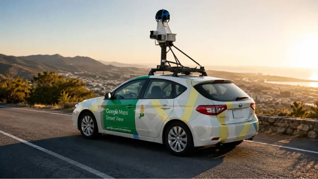
This article is an original analysis supported by the sources cited below
How Street View works
Google’s official explanation of Street View collection, vehicle attribution, mapping plans, and automatic blurring.
Street View imagery policy
Google’s policy describing image age, source attribution, privacy protections, reporting, and permitted treatment of Street View imagery.
Blur Street View imagery
Google Maps Help guidance on requesting additional blurring, permanence, property verification, and effects on future generative-AI prompting.
Use Street View in Google Maps
Google Maps Help instructions for viewing panoramas, checking capture information, and using historical Street View dates.
Maps user-generated content policy
Google’s policy for contributed Maps content, including privacy-related restrictions and reporting standards.
Google Privacy Policy
Google’s general description of personal information processing, purposes, controls, retention, and legal bases.
Large-scale privacy protection in Google Street View
Google researchers’ technical paper on automatic face and license-plate detection and blurring at Street View scale.
Regulation EU 2016/679
The official GDPR text governing personal data, lawful bases, transparency, data-subject rights, and controller accountability in the European Union.
Guidelines 3/2019 on processing of personal data through video devices
European Data Protection Board guidance on identifiability, video observation, lawful processing, transparency, and safeguards.
Guidelines 1/2024 on legitimate interests
EDPB guidance on purpose, necessity, balancing, reasonable expectations, and safeguards under Article 6(1)(f) GDPR.
Respect individuals’ rights
EDPB overview of access, rectification, erasure, restriction, objection, and related data-subject rights.
Updated one-stop-shop case digest on erasure and objection
The EDPB’s 2026 digest of supervisory decisions involving the rights to erasure and objection in cross-border cases.
Opinion 28/2024 on personal data in AI models
EDPB analysis of anonymity, legitimate interests, unlawful source data, and personal data processing in AI-model development and deployment.
What is personal data
UK Information Commissioner guidance on direct and indirect identification, context, pseudonymization, and anonymization.
I have a concern about an image available on Google Street View
The Irish Data Protection Commission’s Street View guidance distinguishing images of identifiable people or plates from property and pet imagery alone.
California Consumer Privacy Act
California Attorney General guidance on consumer rights, covered businesses, deletion, correction, access, and opt-out provisions.
California Privacy Protection Agency frequently asked questions
Official explanations of California privacy-request procedures, verification, confirmation, response periods, and enforcement roles.
Report of findings on Google WiFi data collection
The Office of the Privacy Commissioner of Canada’s findings on payload data collected by Street View vehicles and failures involving purpose, consent, safeguards, and governance.
Google’s collection of WiFi information during Street View filming
New Zealand Privacy Commissioner material on the Street View Wi-Fi inquiry, payload collection, fairness, privacy design, and remedial undertakings.
New Zealand privacy principles
The Office of the Privacy Commissioner’s explanation of the Privacy Act 2020 principles governing collection, storage, use, access, correction, and disclosure.
Chapter 3 APP 3 collection of solicited personal information
Australian Information Commissioner guidance on necessity, sensitive information, and collection obligations under Australian Privacy Principle 3.
Google Street View Australia privacy impact assessment
A published assessment examining Street View’s Australian collection, privacy risks, safeguards, and complaint mechanisms.
Notice of apparent liability for forfeiture DA 12-592
The US Federal Communications Commission’s 2012 notice concerning Google’s Street View Wi-Fi investigation and response to agency inquiries.
Updated release of the Street View notice of apparent liability
The FCC’s fuller release describing categories of sensitive payload data captured during the historical Wi-Fi collection incident.
23rd activity report 2009 and 2010
The German Federal Commissioner’s report covering the political and regulatory dispute over Street View, advance notice, objections, and house blurring.
Panoramic street-level imagery in data-driven urban research
A peer-reviewed review of street-level imagery uses, research access, group privacy, security concerns, and platform gatekeeping.
Measuring walking-to-work using Google Street View imagery and computer vision
A Scientific Reports study demonstrating large-scale feature extraction from more than one million Street View images across Canadian cities.
Deep-learning approach to assess and characterize urban quality and change from street-view imagery
A Scientific Reports study on automated urban assessment, temporal comparison, model limitations, and potential bias in visual indicators.
| Citing this article? Brief excerpts are welcome. Please credit Webiano.digital, name the author where stated, and include a link to https://webiano.digital and to this original article. Full or substantial republication requires prior written permission. Read our Copyright and Content Use Policy. |
This article was prepared with the assistance of artificial intelligence tools. The content underwent expert human review, and Webiano Digital & Marketing Agency assumes editorial responsibility for its final version and publication.