
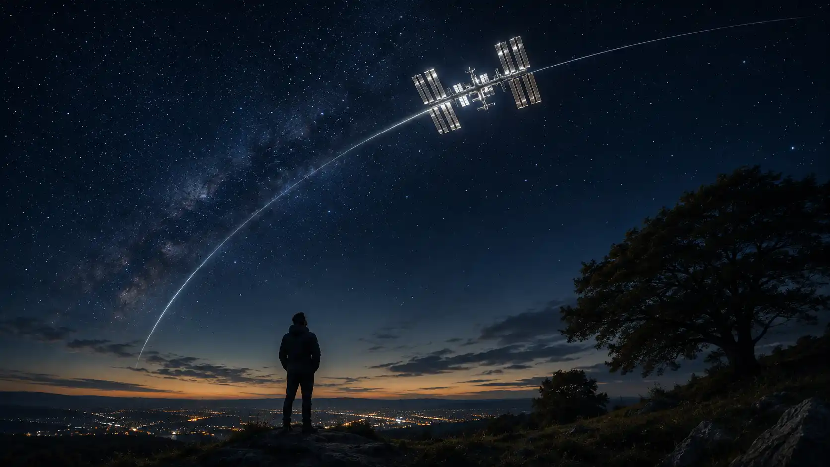
The International Space Station does not look especially dramatic when it crosses the night sky. It resembles a bright, steady point of light moving with quiet purpose, without the blinking lamps, noise, or wandering course of an aircraft. Watch it for a few seconds, though, and the scale of what you are seeing begins to register.
Table of Contents
That point contains laboratories, solar arrays, life-support systems, sleeping quarters, exercise equipment, computers, stored food, experiments, and people. It is travelling at roughly 28,000 kilometres per hour, circling Earth about 16 times a day. Yet from your garden, balcony, pavement, campsite, or supermarket car park, it can look almost modest. A human outpost in orbit passes overhead like a fast-moving star.
The hard part is not seeing it. Under the right conditions, the ISS is conspicuous enough to spot without binoculars or specialist knowledge. The hard part is knowing when the right conditions will exist above your exact location.
That is the small miracle performed by Heavens-Above. Give the site an observing location, open its ISS predictions, and it tells you when to step outdoors, where to look, how high the station will climb, how bright it should appear, and when it will vanish. The event may last only a few minutes. The site reduces an orbital calculation to an appointment you can keep.
There are newer trackers, prettier astronomy apps, official alternatives, augmented-reality viewers, animated globes, and notification systems. Heavens-Above is not the most polished member of that group. Much of the website still looks as though it belongs to an earlier internet, when pages were dense, links were blue, tables were trusted, and nobody regarded white space as a commercial resource.
Yet Heavens-Above remains unusually good at turning orbital mechanics into useful instructions. It does not merely tell you that the ISS exists somewhere above Earth. It tells you that on a particular evening it will appear low in the west-northwest, rise towards the south, reach a certain elevation at a precise local time, and disappear in another direction a few minutes later.
That difference matters. A global map is interesting. A local prediction gets you out of the chair.
The website that turns orbit into an appointment
Heavens-Above starts with a deceptively ordinary setting: your location. You can choose a town, use coordinates, or define a place closely enough for the site to calculate what the sky will look like from where you stand. Once that location is set, nearly everything on the website becomes personal.
The same spacecraft produces a different sighting for every observer. Someone hundreds of kilometres away may see the ISS arc high overhead while you see it skim the horizon. Another observer may be under cloud. Someone farther west may still be in daylight. A pass visible from one city may be completely invisible from another, even though the station crosses both regions during the same orbit.
Heavens-Above takes this local geometry seriously. Its homepage offers a dedicated ISS prediction page, alongside predictions for other notable spacecraft, brighter satellites, amateur-radio satellites, Starlink objects, the Hubble Space Telescope, Tiangong, planets, comets, asteroids, eclipses, and other astronomical targets. The homepage resembles a working index rather than a promotional landing page, and that plainness tells you what kind of project this is.
Select the ISS and the site presents a table of upcoming passes. The core columns are practical: date, brightness, start time, initial altitude and direction, time and position at the highest point, then the end time and final direction. A pass marked with a maximum elevation of 76 degrees is likely to be far more imposing than one that reaches only 14 degrees. A predicted magnitude of minus 3 will be easier to see than a dim positive value.
The table is essentially a stage direction for the sky. At 21:42, look northwest. The station begins low. It climbs. At 21:45 it reaches its highest point in the southwest. At 21:48 it disappears towards the southeast. You do not need to understand the equations that produced those instructions. You need a clock and a clear patch of sky.
The dates and times are shown in local time, which removes one of the most common sources of astronomical confusion. No conversion from Coordinated Universal Time is required once the correct location and time zone have been set. Heavens-Above also lets you move the prediction period backwards or forwards, though its own documentation warns that accuracy declines as predictions extend farther from the present.
The site normally gives the ISS special treatment through a focused prediction period. Its explanatory notes say that visible ISS passes tend to arrive in batches lasting several days, followed by gaps when no suitable evening or morning appearance occurs. An empty prediction table does not mean the site is broken or the station has gone somewhere else. It often means that the station is passing at the wrong time, under the wrong illumination, or too low to make a worthwhile sighting from your position.
That rhythm produces one of Heavens-Above’s more charming effects. You may check the site and discover that nothing useful is happening for a week. Then, suddenly, your location receives several chances in succession: perhaps a dim low pass before dawn, a better evening crossing the next day, and a bright near-overhead appearance two nights later.
The sky acquires a schedule.
There is a psychological shift in that. Most people experience orbital spaceflight through edited photographs, launch broadcasts, agency announcements, or illustrations. The station feels remote because almost every representation arrives through a screen. Heavens-Above uses a screen to tell you when to stop looking at screens.
The site does not promise spectacle beyond what the sky will provide. It cannot make the ISS appear larger. It cannot give the naked eye a view of solar panels or modules. Its achievement is one of timing and attention. It arranges a meeting between an observer standing still and a spacecraft moving several kilometres every second.
The experience is especially good because the preparation is so disproportionate to the event. You may spend less than a minute checking the table. At the appointed time, you walk outside. For the first few seconds, perhaps nothing appears. You scan the wrong patch of sky and wonder whether you misunderstood the compass direction. Then a bright point emerges exactly where the site said it would.
It moves faster than most first-time observers expect. The station does not hang in place like a star, but neither does it flash past like a meteor. It crosses the sky at a pace that allows recognition, anticipation, and a little awe. You can point it out to someone else. You can follow it past a rooftop or between trees. You can watch it brighten as the viewing angle changes.
Sometimes it fades gradually near the horizon. Sometimes it vanishes while still high in the sky because it has entered Earth’s shadow. That disappearance can be the best part: one moment the station is plainly visible, the next it dims and is gone, although you know it is still travelling above you.
Heavens-Above gives each stage a time and direction. The abstraction of an orbit becomes a sequence: appear, climb, cross, fade.
Why the prediction feels almost magical
A satellite is not visible merely because it is overhead. The observer needs darkness while the spacecraft remains lit by the Sun. That combination usually occurs in the hours after sunset or before sunrise, when the ground beneath you has rotated into night but a spacecraft hundreds of kilometres above the surface still catches sunlight.
Deep in the night, a low-orbiting satellite may pass through Earth’s shadow and reflect nothing towards you. During the day, the satellite may be illuminated but lost in the bright sky. The useful window exists between those two failures.
Heavens-Above’s explanation places most visible satellite passes within roughly two hours of sunset or sunrise, using a solar-altitude threshold to decide when the sky should be dark enough. Seasonal and geographical conditions complicate that rule, especially at high latitudes, where summer twilight can persist through the night. What looks like a simple timetable is really a calculation involving your position, the station’s orbit, sunlight, Earth’s shadow, local horizon, and apparent brightness.
This is why a general statement such as “the ISS is over Europe tonight” is nearly useless. Over Europe is not over you. Tonight is not a time. Visible is not guaranteed.
Heavens-Above resolves the ambiguity. The station’s orbital path is known. Your position can be described by latitude, longitude, and altitude. The software can calculate the station’s apparent position relative to your horizon at each moment. It can then estimate whether sunlight reaches the station and whether the reflected light is likely to be strong enough for observation.
The result feels personal because it is personal. Change your location and the table changes. Move the observer from Bratislava to Vienna, from a city centre to a rural hill, or from northern Scotland to southern Spain, and the pass geometry shifts. The spacecraft is the same; the encounter is not.
Brightness estimates deserve a little caution. Heavens-Above uses the astronomical magnitude scale, where lower and negative numbers indicate brighter objects. The ISS can become one of the brightest objects in the night sky, but its exact appearance depends on distance, viewing angle, orientation, reflectivity, atmosphere, and local conditions.
The site’s FAQ is candid about the uncertainty. It can calculate distance and the angle among Sun, satellite, and observer, but the orientation of a spacecraft or tumbling object may be less predictable. The magnitude should be read as a guide, not a contractual promise.
For the ISS, that uncertainty is rarely enough to ruin a strong pass. A high, bright crossing is difficult to miss once you are facing the right direction. Lower passes are less forgiving. Buildings, trees, hills, haze, and urban glow can obscure the first or final part of the path. A maximum altitude of 12 degrees may mean the station spends the whole appearance behind somebody’s roof.
Altitude in this context means angular elevation above the horizon. Zero degrees is the horizon. Ninety degrees is directly overhead. Your fist held at arm’s length spans roughly ten degrees, though hand sizes and technique vary. A pass reaching 70 degrees is a different experience from one peaking at 20. The former can dominate the open sky; the latter may feel like a distant crossing along its edge.
Azimuth gives the compass direction. Heavens-Above usually expresses it with familiar abbreviations: N, NE, E, SE, S, SW, W, NW, plus finer divisions such as WNW or SSE. You do not need precision surveying. A phone compass, a remembered sunset direction, a street map, or basic knowledge of nearby landmarks is enough.
The station’s apparent route also depends on where you place yourself. A garden surrounded by houses may offer poor horizons but a clear overhead view. A field gives a longer arc. A balcony may face the wrong half of the sky. The best observing site is not necessarily dark; it is unobstructed in the predicted direction.
Light pollution matters less for the ISS than it does for faint stars. The station can remain obvious above a city. Clouds matter much more. Thin cloud may reduce brightness or produce a soft halo. Thick cloud ends the attempt completely. Heavens-Above predicts orbit and illumination, not local weather, so a forecast remains the other half of the plan.
The most satisfying pass is often one that begins low, climbs above 50 or 60 degrees, stays visible for several minutes, and carries a bright negative magnitude. That combination provides time to locate the station, call someone outside, and follow the whole traverse.
A precise prediction changes the emotional quality of waiting. Without one, you scan randomly and give up. With one, the empty sky before the pass feels charged. Ten seconds early is anticipation. Ten seconds late creates mild panic. When the light arrives on cue, the event feels impossible even though the whole point of the website is that it was calculable.
The magic comes from accuracy meeting scale. A webpage tells you that a machine the size of a football field will cross a specific piece of your sky at 21:17. You walk outside. At 21:17, it does.
Reading a pass without becoming an astronomer
Heavens-Above presents more information than a first-time observer needs. That is part of its character. The website assumes that data should remain available rather than be hidden behind a simplified card. You are allowed to ignore most of it.
For a casual ISS sighting, five pieces of information matter most: the date, start time, starting direction, maximum elevation, and predicted brightness. The end direction becomes useful once you have found the station and want to follow its full route.
The useful parts of an ISS prediction
| Field | What it tells you | Why it matters |
|---|---|---|
| Start time | When the station first becomes visible | Be outside a minute or two early |
| Start direction | Where it appears near the horizon | Face the correct part of the sky |
| Maximum altitude | How high the pass will climb | Higher passes are usually easier and more dramatic |
| Brightness | Estimated apparent magnitude | More negative values mean a brighter object |
| End time and direction | Where the visible pass finishes | Helps you follow the complete arc |
| Pass chart | The route against stars and directions | Useful when buildings or unfamiliar horizons complicate the view |
The table rewards selective reading. You can treat it as an expert instrument or reduce it to one plain instruction: “Go outside at 21:15, face west, and look for a bright moving point.”
Begin with the date. This sounds obvious, but late-evening and early-morning predictions can produce mistakes, especially around midnight. Check that you are reading the correct row and that the displayed location is yours.
Next, notice whether the page is showing visible passes or all passes. Heavens-Above can list orbital crossings that happen in daylight or under poor lighting conditions, but those are not useful for naked-eye viewing. For an ordinary sighting, the visible-only setting is the sensible filter.
Then look at the start time. Go outside at least a minute early, preferably two or three. A pass may begin behind a low obstruction, and finding the correct direction takes longer in darkness than it does while studying a chart indoors.
Face the start direction and search just above the horizon. The ISS may initially look faint, then brighten as it climbs. Do not expect it to burst into view like a meteor. It usually announces itself through steady motion.
Distinguishing it from an aircraft is straightforward after a few seconds. Aircraft typically display blinking navigation lights, may change apparent speed or direction, and often make noise. The ISS appears as a constant or slowly changing light without regular flashes. NASA describes it as resembling a bright star or aircraft moving across the sky, except that it does not blink or alter course.
The station also tends to move faster across the sky than a distant airliner. Close aircraft can still cause confusion, particularly near airports, but a predicted ISS path provides a strong check. If the object appears from the expected direction at the expected second and follows the charted arc, identification is not difficult.
Maximum elevation deserves more attention than most newcomers give it. A bright pass with a low maximum elevation can still disappoint because haze and obstacles dominate the horizon. A moderately bright pass climbing almost overhead may be far more satisfying.
Treat 10 to 20 degrees as vulnerable territory. A house, tree line, ridge, or neighbouring building can erase the entire event. Thirty to 50 degrees gives a comfortable view from many locations. Anything above 60 degrees feels properly overhead, and passes approaching 90 degrees can seem startlingly fast as the station sweeps across a large angle of sky.
The brightness number uses a scale that runs opposite to everyday intuition. Minus 4 is brighter than minus 2; minus 2 is brighter than plus 1. You do not need to memorise comparisons with planets or stars. For practical purposes, negative is good. A strongly negative prediction usually means you will not need optical aid or dark adaptation.
Binoculars are unnecessary for finding the ISS and can make tracking harder because their narrow field of view magnifies every movement of your hands. Some experienced observers use magnification, and astrophotographers attempt detailed images with specialised equipment, but the ordinary pleasure is naked-eye observation.
A pass chart adds another layer. Clicking the date or detail link usually produces a visual route across the local sky, showing the station’s track relative to directions, stars, and constellations. This helps when the table says “starts WNW, highest SW, ends SSE,” but your observing site contains obstacles in some of those directions.
The chart lets you translate geometry into landmarks. Perhaps the station will emerge to the left of a church tower, pass above a bright planet, cross the open gap between two apartment blocks, then enter Earth’s shadow before reaching the southern roofline.
Heavens-Above also provides ground tracks and orbit views. These are fascinating, especially when you want to understand why the pass occurs, but they are secondary to the sky chart for practical observation. The ground track shows where the station is travelling over Earth. The sky chart shows what you will see.
There is a temptation to keep the phone in your hand during the entire pass. Resist it. Screens interfere with night vision, camera attempts become distracting, and a smartphone photograph of a small bright point usually captures less than the eye experienced.
Use the site to prepare, then put the device away. The event is brief enough that dividing attention has a noticeable cost.
Photography is possible, but it changes the activity. A basic long exposure can record the station as a bright line across the frame. A carefully planned composition might place that line above a building, monument, mountain, or tree. Capturing structural detail in the station requires far more demanding equipment and technique.
For a first encounter, observation is enough. The person beside you may be more impressed by the timing than by the appearance. Tell them where to look, wait, and let the point of light arrive.
Children respond especially well because the event has a clear beginning and a human story. The object is not an anonymous star. People live inside it. They are moving around Earth while the observers remain in one place.
The station is simultaneously remote and local. It may be hundreds of kilometres above the surface, yet the line of sight belongs to your own street.
A dated interface with unusually good judgment
Heavens-Above does not hide its age. The website contains compact text, long indexes of links, functional tables, old and new chart styles, and a visual language that predates the modern obsession with enormous headings and animated product claims.
The project itself has acknowledged this. On a page introducing its live sky chart, Heavens-Above noted that the site had been online for more than 20 years in roughly the same format and described the chart as part of an effort to improve the design and mobile experience. Few websites publish such a frank assessment of their own appearance.
The redesign remains partial. Some pages feel more modern than others. Navigation can shift between compact legacy layouts and richer interactive displays. On a small screen, the amount of information may feel crowded. The site is not a model of contemporary interface consistency.
Yet its old structure possesses a quality that many modern services have discarded: it assumes the user came to obtain information, not to be persuaded to stay.
There is no elaborate onboarding ritual. No full-screen brand film blocks access to the calculation. No artificial story scroll introduces the concept of satellites. No pop-up asks which kind of sky enthusiast you are before revealing the relevant table.
Set the location. Click ISS. Read the pass.
The homepage is dense because the project does more than one thing. It contains satellite predictions, a database, ISS altitude information, Starlink displays, amateur-radio passes, deep-space mission pages, solar-system charts, comet and asteroid information, eclipse material, and several interactive visualisations. Its density is the result of accumulated utility rather than content marketing.
That distinction gives Heavens-Above the atmosphere of an observatory noticeboard maintained by someone who expects visitors to know what they want, or at least to explore the labels. The site is not afraid of technical nouns. It offers enough context to interpret them, but it does not convert every function into a lifestyle slogan.
The prediction tables are a fine example of restrained design. Their job is to present multiple passes for comparison. Cards would waste space. A conversational assistant would slow the scan. A map alone would obscure exact timing. A table is the correct shape for the information.
This is not nostalgia for ugly websites. There are real usability problems in legacy interfaces. Small tap targets, inconsistent page structures, limited responsive behaviour, unexplained abbreviations, and crowded charts can exclude or frustrate users. Heavens-Above occasionally asks more patience than a casual visitor will give it.
The remarkable point is that the underlying editorial decisions remain sound. The project knows which quantities matter. It places location at the centre. It separates visible passes from all orbital passes. It shows start, culmination, and end. It exposes uncertainty rather than disguising every forecast as certainty.
The site understands the observing task.
That task knowledge is harder to replace than surface design. A beautifully animated tracker may show a photorealistic Earth rotating beneath thousands of orbit lines, but such a display can leave the user asking the same practical question: when should I go outside?
Heavens-Above answers it before offering spectacle.
Its datedness may even sharpen the encounter. The plain table creates low expectations. Nothing in the presentation feels theatrical. Then the prediction works, and a moving light appears above your house within seconds of the listed time.
The real world supplies the animation.
There is also something healthy about a digital project whose successful outcome occurs away from the product. Most websites measure success through continued attention: another page, another video, another refresh, another notification. Heavens-Above succeeds when you close the browser and look up.
The project does offer an official Android app. According to its Google Play listing, the app includes ISS and satellite pass predictions, a live sky chart, amateur-radio satellite information, orbit and ground tracks, calendar integration, a red-on-black night mode, and a tracker that uses device orientation. Calculations are performed locally, with orbital data needing periodic updates rather than a continuous connection.
That local-calculation model suits the activity. Observing sites may have poor reception. A remote hill, field, or campsite is exactly where a sky tool should not become useless after losing a signal. The app treats connectivity as a way to refresh the ingredients, not as a requirement for every prediction.
The free Android version is financed through advertising, while a paid Pro version removes adverts. The website also carries advertising, and Heavens-Above has said that ad income supports the service.
The ads are a compromise rather than a design strength. They can distract from an otherwise focused tool, and users concerned about tracking should read the privacy material rather than assume a small astronomy service collects nothing.
The site’s privacy policy says Heavens-Above gathers standard non-personally identifying browser and usage information, may collect IP addresses, uses cookies, and collects account information when someone creates a personalised login. It also notes that advertising partners may set their own cookies. Anonymous access is possible, but anonymous does not mean invisible to every layer of web infrastructure.
A login is optional for the core website experience. You can set a location and inspect predictions without building an identity around your interest in the sky. An account becomes useful when you want preferences to persist across visits.
That modest friction profile is part of the site’s appeal. The service asks for the one fact necessary to make the calculation useful: where you will be observing. Everything else is secondary.
The ISS is the doorway, not the whole site
Most people will discover Heavens-Above through the International Space Station because the ISS is bright, inhabited, culturally familiar, and relatively easy to observe. The project’s deeper identity emerges after that first successful pass.
The homepage lists predictions for many visible satellites and objects of special interest. It also includes a daily prediction page for brighter satellites, an extensive satellite database, amateur-radio passes, Starlink-related views, astronomy charts, comets, asteroids, planets, eclipses, and several odd orbital excursions.
Heavens-Above is less an ISS tracker than a local observatory for moving objects.
Once you have watched the station, other lights become legible. A point drifting across the sky is no longer automatically “a satellite” in the vague sense. It may be a rocket body, a communications satellite, a scientific observatory, a crewed station, or one member of a recently deployed group.
The daily brighter-satellite page provides passes above a selected brightness threshold. This is where the site becomes addictive for patient observers. An evening that appeared empty may contain several artificial objects crossing different parts of the sky.
Some are steady. Some brighten and fade. Tumbling rocket bodies can pulse as reflective surfaces rotate. The project’s FAQ explains that leftover fuel, venting, leaks, failures, and orbital breakups may cause objects to spin, producing brightness variations visible from the ground.
The night sky starts to reveal human debris, infrastructure, science, and history.
A spent rocket stage is not visually impressive in the conventional sense. It is a dot. Yet knowing what the dot is changes the observation. It may have launched a mission decades ago and remained in orbit ever since. It may be crossing above national borders that have changed while the hardware continues on the same gravitational path.
The Hubble Space Telescope offers another recognisable target, though it is generally dimmer and less consistently dramatic than the ISS. Tiangong, China’s crewed space station, can also produce visible passes. Bright commercial satellites and large antenna structures occasionally attract attention because of their unexpected brightness.
Starlink created a new kind of public satellite observation. Shortly after launch, a group may appear as a line or train of points, an uncanny sight that has generated excitement, confusion, and serious concern among astronomers. Heavens-Above includes tools for viewing Starlink passes and orbital configurations, making the service useful both for people trying to see them and those trying to understand what they saw.
The amateur-radio section reveals another community entirely. Radio operators use pass predictions to know when a suitable satellite will rise above their horizon, how long communication may be possible, and which frequencies are involved. The Android app includes uplink and downlink information for radio satellites. A page that looks like a niche timetable may be coordinating brief conversations through orbiting equipment.
Heavens-Above also keeps orbital curiosity from becoming too tidy. Its homepage links to spacecraft escaping the Solar System, an interactive animation of the Tesla Roadster trajectory, memorial missions, and other objects whose existence sounds fictional until you inspect the calculation.
These pages embody the older web at its best: specific, slightly eccentric, technically serious, and maintained because someone believes the information should be available.
The deep-space pages do not serve the same immediate function as an ISS pass prediction. You cannot step outside and watch every listed object. Their appeal lies in perspective. A spacecraft may be too distant and faint to observe, but its position and trajectory remain calculable. Heavens-Above extends the pleasure of knowing where things are, even when sight cannot follow.
Its astronomy section broadens the scope further. Solar and lunar information, planetary positions, sky charts, constellations, comets, asteroids, and eclipse material sit beside the satellite tools. The project’s name becomes literal: it is an index of what is above you, filtered through time and place.
The live sky chart moves visible satellites across a star field and supports a darker viewing mode intended to reduce glare outdoors. The project described it as a step towards pages that update continuously on the device rather than requiring repeated server refreshes. It is one of the places where the site’s old informational instincts meet a more contemporary interactive form.
The chart can be more immediately engaging than a table, but the table remains better for planning. Motion attracts attention; rows support decisions. Heavens-Above wisely keeps both.
Its satellite database also serves identification. Enter the name or catalogue number of an object, inspect its orbital information, and generate passes for your location. This is not merely for professional researchers. Amateur observers often begin with a mysterious light and work backwards.
The question changes from “Was that a satellite?” to “Which satellite was that?”
Perfect retrospective identification is not always possible. Multiple objects may cross similar parts of the sky. Times can be remembered poorly. Brightness changes. Aircraft and lanterns complicate reports. Newly launched or manoeuvring spacecraft may have updated orbital data. Yet the database narrows the possibilities.
The ISS remains unusually easy because it is bright and its path is closely tracked. It also benefits from cultural recognition. An observer who would feel little attachment to an anonymous payload may care deeply that astronauts are inside the light.
The human presence is not visible, but it alters the meaning. You are not merely watching hardware reflect sunlight; you are watching a place where people are awake, working, eating, exercising, speaking to mission control, or looking back at Earth.
That knowledge turns a pass into a shared event. Families wave. Teachers bring students outdoors. People message neighbours with the time. Someone who saw the station once may check future passes from holiday destinations or a new home.
Heavens-Above encourages that behaviour because changing the observing location is easy. Before a trip, you can see whether a good pass will occur over a campsite, beach, mountain village, or city. The result depends on local geometry, so the same holiday can contain an event unavailable at home.
There is no need to make every observation solemn. Sometimes the station appears while you are taking out rubbish. Sometimes the forecasted bright pass is hidden by one infuriating cloud. Sometimes a child looks in the wrong direction until the final ten seconds. The charm comes partly from placing orbital grandeur inside ordinary life.
You do not travel to a launch site. Space comes over the fence.
Why this small tool says something larger about the web
Heavens-Above belongs to a class of websites that do one consequential thing without continually announcing their importance. Their value is clearest in use. The visitor arrives with a concrete need, receives an answer, and leaves with a changed relationship to something outside the browser.
The project does not manufacture an experience; it reveals one that was already going to happen.
The ISS would cross your region whether you knew it or not. Sunlight would strike its structure. The reflection would reach the ground. The station would appear above the horizon, climb, and disappear. Heavens-Above inserts knowledge into that sequence.
This is a different model from entertainment platforms, where the product owns the content and controls the timing. Heavens-Above owns neither the sky nor the spacecraft. It organises public orbital information around the observer.
The distinction creates trust. When the site predicts a pass, reality can verify it within minutes. A successful result is not a conversion metric hidden inside the company; it is a light arriving in the correct place.
Failures are equally visible. Cloud intervenes. The observer misreads east and west. A brightness estimate proves optimistic. The location is wrong. The time zone is misconfigured. Orbital manoeuvres reduce accuracy. The project cannot smooth those failures with interface language.
Its documentation acknowledges many of them. Longer-term predictions become less reliable. Brightness is approximate. Location matters. Visible-pass filters use a darkness threshold that may omit a bright object seen in twilight. Some very high-latitude locations receive poor ISS geometry.
The honesty makes the prediction more credible, not less.
Modern software often conceals uncertainty behind a confident surface. Heavens-Above exposes the assumptions. The user can switch from visible passes to all passes, inspect the sky track, change dates, compare magnitudes, and see orbital context.
It treats the visitor as capable of interpretation. This can make the first encounter feel technical, but it also prevents the service from becoming a black box.
The site’s continued usefulness says something about specialised knowledge. General-purpose mapping platforms excel at roads, businesses, terrain, and terrestrial navigation. Weather services predict clouds and rain. Calendar tools organise appointments. Heavens-Above occupies the narrow seam between orbital data, local geography, sunlight, and human attention.
That seam is too specific to dominate public conversation and too useful to disappear.
A person may visit only a few times a year. The site does not need to become a daily habit to justify its existence. One excellent ISS pass can make the tool memorable for years.
This is an unfashionable form of digital value. Many products chase frequency, retention, and dependency. Heavens-Above supports occasional use. You remember it when a child asks what that light is, when visitors arrive on a clear evening, when a bright pass is mentioned, when you travel somewhere with open skies, or when you suddenly want proof that the orbital world intersects your address.
The website waits without demanding loyalty.
Its international usefulness also deserves attention. The prediction is not tied to a small list of famous viewing cities. Set coordinates and the calculation follows. The homepage supports many languages, and the underlying concept translates without much cultural explanation: your location, a time, a direction, a moving light.
Access still depends on devices, connectivity, location accuracy, unobstructed skies, and the ability to interpret visual information. It is not universal. Yet the core event is unusually public. You do not need a telescope, ticket, subscription, dark-sky reserve, or observatory dome to watch a strong ISS pass.
NASA’s Spot the Station provides an official alternative with alerts, schedules, real-time tracking, and mobile apps. For someone who wants a friendlier ISS-only experience, NASA’s service may be the more obvious choice.
Heavens-Above becomes more compelling when curiosity spreads beyond the station. It offers richer satellite coverage, detailed pass tables, radio-satellite information, older technical pages, orbital displays, and the peculiar depth of a project built around long-term interest rather than a single campaign.
NASA’s tool introduces the station. Heavens-Above introduces the moving sky.
The two services need not compete. A newcomer might use Spot the Station for notifications and Heavens-Above for deeper inspection. The best tool is the one that gets the person outdoors at the correct time.
Accuracy also depends on updated orbital information. The ISS does not travel along a perfectly fixed track. Atmospheric drag affects its orbit, and mission controllers periodically adjust its altitude. NASA says trajectory information is updated regularly because small errors accumulate and manoeuvres alter future positions.
This explains why the most reliable pass plans are made near the observation date. A prediction for tonight is more dependable than one copied into a calendar months earlier. Orbit is predictable, but not frozen.
The Heavens-Above Android app partly addresses this by downloading fresh orbital information and performing subsequent calculations on the device. The website performs the equivalent service through its current prediction pages.
For ordinary observing, the remaining error is usually smaller than the human error introduced by arriving late, choosing a blocked horizon, or facing southeast when the table says southwest.
The practical ritual is simple. Check the pass on the day. Confirm the location. Look at the weather. Identify the starting direction before dark. Go out early. Keep watching for the full predicted interval.
Then let the calculation disappear behind the experience.
The best moment on Heavens-Above occurs after you no longer need the website.
What people usually want to know before stepping outside
The website can be used without paying, and its main satellite prediction functions are accessible without a mandatory account. Advertising appears on parts of the site and helps finance it. The official Android app also has a free, ad-supported edition, while the Pro edition removes advertising.A login is optional on the website. Creating one is useful for saving preferences, but you can set an observing location and retrieve ISS predictions as an anonymous visitor.The project’s funding model produces a little visual clutter, especially on pages where the prediction table should be the natural focus. The compromise remains tolerable because the core answer is not held behind a subscription screen.
No. The website is sufficient for planning an ISS sighting. Set your location, open the ISS page, and inspect the upcoming visible passes.The Android app becomes useful when you want local calculations, calendar integration, a live sky chart, night mode, device-orientation tracking, radio-satellite details, and easier field use. It only needs periodic data updates because predictions are calculated on the phone.The website’s homepage currently directs visitors to the official Android app. People using other mobile platforms can still use the browser version, though some pages are more comfortable on a larger screen.
Near-term predictions are usually accurate enough for naked-eye observation, provided your location and time zone are correct and the orbital information is current.Heavens-Above limits its main ISS window because predictions become less dependable farther into the future. The station’s orbit is affected by atmospheric drag and deliberate manoeuvres, and trajectory data must be updated.For a strong pass, checking on the same day is sensible. Be outside a few minutes early. The most common observing problems are not dramatic prediction errors but clouds, blocked horizons, incorrect directions, and late arrivals.
The station has entered Earth’s shadow. It remains above the horizon and continues along its orbit, but direct sunlight no longer reaches it, so the reflected light fades from view.This can happen while the ISS is still at a high elevation. The effect is striking because the station seems to switch off in open sky rather than descend behind the horizon.The reverse can occur before dawn: a satellite may emerge from shadow and suddenly become visible partway through its apparent path.
Visible passes arrive in batches, followed by gaps. The ISS may be crossing your region during daylight, when the sky is too bright, or late at night, when the station itself is in shadow. It may also remain too low above your horizon to make a useful appearance.Check that your observing location is correct and that the page is set to the intended dates. You can view all passes rather than visible-only passes to confirm that the station is still crossing your local sky under unsuitable lighting conditions.Waiting several days often reveals a new run of morning or evening opportunities.
Yes. A bright ISS pass is often visible through urban light pollution. Unlike faint galaxies or dense star fields, the station can become bright enough to stand out above street lighting and illuminated buildings.Your larger problem will be obstruction. Tall buildings restrict the horizon and may hide low passes. Choose a place with an open view in the predicted direction, such as a park, bridge, square, riverside path, playing field, or broad street.Cloud, haze, and direct glare from nearby lamps can still spoil the view.
No optical equipment is required. The ISS is best found with the naked eye because the field of view is wide and the station moves quickly across the sky.Binoculars can reveal a brighter, more intense point but make tracking harder. A telescope capable of resolving structural detail requires careful preparation, fast tracking, suitable optics, and considerable skill.For a first sighting, leave the equipment indoors. Find the station, follow its motion, and experience the prediction working.
Expect a bright point of steady light moving smoothly across the sky. It does not display the regular blinking pattern of an aircraft and does not streak away in a second like a meteor. NASA compares its appearance to a bright star or fast aircraft without flashing lights or changes in direction.Its brightness may change gradually during the pass. Atmospheric haze can soften it near the horizon. At high elevation, its apparent speed across the sky often seems to increase.You will not see astronauts, modules, or solar panels with the naked eye. The significance comes from knowing what the light contains.
The official Heavens-Above Android app supports calendar integration, allowing interesting passes to be saved so they are harder to forget.NASA’s Spot the Station service is another option for ISS-focused notifications and flyover schedules, with official mobile apps available through major app stores.A simple calendar reminder also works. Include the start time, initial compass direction, and a note to go outside three minutes early.
Location is fundamental to the prediction. The site needs it because the apparent direction, elevation, timing, and visibility of a pass differ from place to place.For ISS viewing, choosing the correct town or a nearby coordinate is usually enough. More position-sensitive phenomena and low passes benefit from greater precision. The site’s older material on satellite flares notes that some predictions can be highly sensitive to location errors.Avoid saving an exact home coordinate when a nearby public location provides enough accuracy for your use. The privacy trade-off depends on whether you remain anonymous, create an account, permit browser location access, or use the mobile app.
The website’s privacy policy says it collects common browser and server information, including browser type, language preference, referring page, request time, and IP addresses. Accounts require details such as a username and email address. The site uses cookies, and advertising partners may use their own cookies.The policy says Heavens-Above does not sell or rent personally identifying information, though it describes limited circumstances in which data may be disclosed or transferred.Anyone with strict privacy requirements should read the current policy, use browser controls, avoid unnecessary account creation, and consider entering a nearby observing point rather than an exact private address.
They serve overlapping but different appetites. Spot the Station is the cleaner choice for someone who mainly wants official ISS schedules, alerts, and a straightforward mobile experience. Heavens-Above is richer for people who want detailed pass geometry, broader satellite coverage, radio-satellite data, sky charts, object databases, and orbital curiosities.The sensible choice may be to use both. Let an alert remind you that the station is coming, then open Heavens-Above to inspect the path and compare the pass with other visible objects.Tool loyalty matters less than being in the right place at the right minute.
It can narrow the possibilities when you know the time, place, direction, and approximate path. The site lists bright satellite passes and lets you inspect individual objects. A light that matches a predicted pass closely is likely to be the listed satellite.Identification becomes harder when the observation time is vague, several objects were present, or the light behaved unlike an orbiting satellite. Aircraft, drones, lanterns, meteors, reflections, and astronomical objects can all cause confusion.A satellite generally follows a smooth path without abrupt turns. Regularly blinking coloured lights point more strongly towards an aircraft.
Apparent brightness depends on more than distance. Spacecraft orientation, reflective materials, viewing geometry, atmosphere, and rotation all affect how much sunlight reaches the observer.Heavens-Above states that its magnitude estimates should be treated as approximate, especially when an object’s orientation is unknown or changing. Tumbling rocket bodies may brighten and fade rhythmically as reflective surfaces rotate.The ISS is more dependable than many uncontrolled objects, but even its brightness can vary through a pass.
The underlying task is wonderfully simple for children: wait until the listed time, face the listed direction, and find the moving light.An adult may need to interpret the table, choose a safe observing spot, and explain compass directions. Once outdoors, no technical vocabulary is required. A bright ISS pass is one of the easiest ways to connect an abstract subject such as orbital flight with direct observation.The best explanation is concrete: people are living inside that light, and it will circle Earth again in roughly an hour and a half.
A low pass is worth trying when your horizon is open, the predicted brightness is strong, and you are curious enough to accept failure.From a built-up area, a maximum elevation below 15 or 20 degrees is often hidden. From a beach, hilltop, field, or broad plain, the same pass may remain visible for several minutes.High passes deserve priority because they are easier to find and feel more immediate. Low passes are good practice in reading azimuth and learning the shape of your horizon.
Choose an evening pass with a strongly negative magnitude and a maximum elevation above 40 degrees. Evening timing is usually more convenient than pre-dawn, and a high arc reduces obstruction problems.Make sure the weather is clear enough, identify the starting direction, and arrive early. Invite one other person. Explaining where the station will appear reinforces your own understanding and turns a solitary observation into a small shared event.A pass above 60 degrees is ideal, but waiting for perfection is unnecessary. The important threshold is one that gets you outside.
No. The station’s orbit has an inclination of about 51.6 degrees, which limits how far north and south its ground track travels. Observers beyond those latitudes can still see it under some circumstances, but it will not pass directly overhead, and very high-latitude viewing geometry can be poor.Even within the orbital latitude band, most passes will not reach 90 degrees from a given site. A true overhead pass requires a close alignment between the station’s path and the observer.This is why maximum elevation changes from one appearance to the next.
Keep looking. Do not immediately turn to the phone, photograph the screen, or begin searching for the next object.Watch the station cross the entire visible arc. Notice whether it brightens. Observe its speed near the highest point. See whether it reaches the horizon or vanishes into shadow.Then check the table again and connect the observed path with the numbers. That small comparison teaches more than an animated simulation because the geometry has entered your own surroundings.Heavens-Above earns its place among the web’s enduring specialist projects through this repeated conversion. It turns coordinates into a direction, orbital data into a time, and a distant spacecraft into something that passes over your own roof.The interface may look old. The table may appear dry. The underlying result is neither.At a precisely predicted moment, a bright point arrives. You follow it across the sky, carrying people and machinery through sunlight above the darkened ground. A few minutes later, it is gone.
The webpage gave you an appointment with orbit, and orbit kept it.
Author:
Jan Bielik
CEO & Founder of Webiano Digital & Marketing Agency
This article is an original analysis supported by the sources cited below
Heavens-Above
The official Heavens-Above homepage, used to verify the project’s location-based satellite tools, ISS predictions, brighter-satellite pages, live charts, satellite database, astronomy sections, Android app link, and project ownership.
Heavens-Above explanatory notes
The project’s official explanation of satellite visibility, sunlight and Earth-shadow conditions, ISS prediction batches, orbital inclination, visibility thresholds, and the declining accuracy of longer-range forecasts.
Heavens-Above frequently asked questions
Official guidance on local times, visible-pass conditions, brightness estimates, changing prediction periods, object orientation, location accuracy, and unexpected satellite observations.
Heavens-Above privacy policy
The official policy describing website and app data practices, account information, IP addresses, cookies, advertising partners, and disclosure principles.
Heavens-Above Android app
The official Google Play listing used to verify pass predictions, local calculations, live sky charts, radio-satellite information, night mode, calendar integration, advertising, and other app functions.
The Heavens-Above live sky chart
The project’s own note on its evolving interface, long-running website design, mobile ambitions, dark viewing mode, client-side processing, known limitations, and advertising model.
NASA Spot the Station
NASA’s official ISS viewing resource, used for comparison and for information on station appearance, viewing conditions, orbit inclination, speed, trajectory updates, alerts, schedules, and mobile access.
| Citing this article? Brief excerpts are welcome. Please credit Webiano.digital, name the author where stated, and include a link to https://webiano.digital and to this original article. Full or substantial republication requires prior written permission. Read our Copyright and Content Use Policy. |
This article was prepared with the assistance of artificial intelligence tools. The content underwent expert human review, and Webiano Digital & Marketing Agency assumes editorial responsibility for its final version and publication.